Victorian Resources Online (archived)
SFS19b
Location: Teesdale.
Australian Soil Classification: Ferric, Eutrophic, Brown CHROMOSOL
General Landscape Description: Level plain within a gently undulating plain tending to gently undulating rises
Site Description: Southern Farming Systems (SFS) raised bed site.
Geology: Moorabool Viaduct Formation
Native Vegetation: Remnant Red gum (Eucalyptus camaldulensis).
Land Use: Wheat.
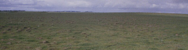 SFS19b Landscape. |
Soil Profile Morphology:
Surface Soil
| Ap | 0-18 cm | Loam: | 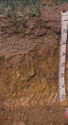 SFS19b Profile. |
| A2c | 18-30/35 | Abundant coarse gravel with slight alluvial quartz; abrupt and wavy change to: | |
| Subsoil | |||
| B21 | 30/35-65 cm | Brown (10YR4/3) with red (10R4/8) mottles; light clay; coarse ferruginised sand, bleached margins of fractures which contain illuviated clay; strong consistence dry; pH 6.0. |
Key Profile Features:
- Strong texture contrast between surface (A) horizons and subsoil (B21) horizon.
Soil Profile Characteristics:
pH | Salinity Rating | |||
Subsoil (B21 horizon) | Moderately Acid | Low | Non-Sodic | None1 |
Horizon | Horizon Depth (cm) | pH (water) | pH (CaCl2) | EC dS/m | Exchangeable Cations | |||
Ca | Mg | K | Na | |||||
meq/100g | ||||||||
B21 | 30-65 | 6.0 | 5.4 | 0.20 | 4.7 | 7.9 | 1.1 | 1.2 |
Horizon | Horizon Depth (cm) | Exchangeable Aluminium mg/kg | Exchangeable Acidity meq/100g | Field Capacity pF2.5 | Wilting Point pF4.2 | Coarse Sand (0.2-2.0 mm) | Fine Sand (0.02-0.2 mm) | Silt (0.002-0.02 mm) | Clay (<0.002 mm) |
B21 | 30-65 | <10 | 11.0 | 40.5 | 28.5 | 6 | 3 | 3 | 88 |
Management Considerations:
Whole Profile
- Plant available water capacity (PAWC) is considered to be low/medium (estimated at 100 mm) in the upper 80 cm of this soil profile. Effective rooting depth (ERD) is restricted to 80 cm due to the basalt below this depth.
Profile Described By: Richard MacEwan & Mark Imhof (September 2000).