Victorian Resources Online (archived)
Archived content — This page contains material from the Victorian Resources Online (VRO) website. It is no longer maintained and is provided for reference only. This content is hosted by CeRDI and is not endorsed by Agriculture Victoria.
Sitemap
15.2 Chapple Creek Ford - Fossil Plants
|
This information has been developed from the publications:
- Sites of Geological and Geomorphological Significance in the Western Region of Melbourne (1986) by Neville Rosengren
- Sites of Geological and Geomorphological Significance on the Coast of Port Phillip Bay (1988) by Neville Rosengren.
- Sites of Geological and Geomorphological Significance in the Shire of Otway (1984) by Neville Rosengren.
Geological heritage sites, including sites of geomorphological interest and volcanic heritage sites, are under regular revision by the Geological Society of Australia, especially in the assessment of significance and values. Reference should be made to the most recent reports. See the Earth Science Heritage (external site) section of the Geological Society of Australia website for details of geological heritage reports, and a bibliography. |
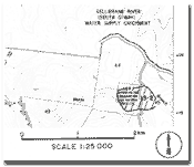
| Location: | 15-062194. Four kilometres north of Lavers Hill at the ford across Chapple Creek - North Branch. | |
Access: |
Morris Track off Mt McKenzie Road. |
Ownership: |
Private land. |
Geology: |
Exposures of Lower Cretaceous sediments at the cross of Morris Track over the Chapple Creek North Branch have yielded fossil plant remains. They have been placed in the Zone D (Aliban) biostratigraphic unit (Douglas, pers. comm.). |
Significance: |
State. This site is one of the few known to yield megafloral remains in the inland part of the Otway Ranges. It therefore contributes substantially to the understanding of the biostratigraphical subdivision of the rocks of the Otway Group. |