Victorian Resources Online (archived)
Soil/Landform Unit 173
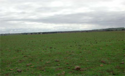
 These gently undulating sedimentary plains are mainly used for cropping and grazing |
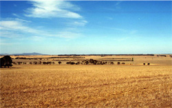
0.08 % of CMA region This unit is a gently undulating sedimentary plain within the Western Plains. This unit is a small unit of two occurrences (east of Bannockburn and north of Anakie) consisting of very low relief and slow site drainage, apart from the drop to lower terrain. The main occurrence is north-west of Moorabool and is bound east and west by incised drainage valleys (including the Moorabool River valley) and is influenced by basaltic material from the north. The soils are alkaline texture contrast soils that are generally strongly sodic with poor permeability and mainly used for grazing. The surface soils are light (mainly sandy loams) with a limited nutrient holding capacity and poor structure, influenced by the sodic subsoil. |  |
 Undulating basalt plain east of Bannockburn | 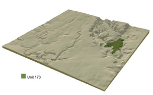 |
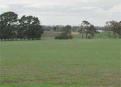
 |  Undulating basalt plain highlighting basalt rocks at the surface. |
Component | 1 | 2 | 3 |
Proportion of soil-landform unit | 95% | 3% | 2% |
| CLIMATE Rainfall (mm) | Annual: 550 | ||
| Temperature (oC) | Minimum 9, Maximum 19 | ||
| Precipitation less than potential evapotranspiration | October–April | ||
| GEOLOGY Age and lithology | Neogene fluvial and marine sediments, Quaternary basalt and minor Paleogene tholeiites and pyroclastics | ||
| Geomorphology | |||
| LANDUSE | Uncleared: Nature conservation Cleared: Beef cattle and sheep grazing; occasional cropping (cereal) | ||
| TOPOGRAPHY Landscape | Undulating plains | ||
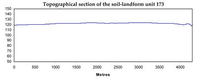
| Elevation range (m) | 45–147 | ||
| Local relief (m) | 3–5 | ||
| Drainage pattern | Dendritic | ||
| Drainage density (km/km2) | 0.7 | ||
| Landform | Long gentle slopes | Drainage line | Stony rises |
| Landform element | Slopes | Depression | |
| Slope and range (%) | 1 (1–3) | 1 (1–2) | 3 (2–5) |
| Slope shape | Straight | Straight | Convex |
| NATIVE VEGETATION Ecological Vegetation Class | Plains Grassy Woodland (0.1%) | ||
| Dominant species | E. leucoxylon | ||
| SOIL Parent material | Unconsolidated sediments (sand and clay) with in situ weathered rock | Alluvium | In situ weathered basalt |
| Description (Corangamite Soil Group) | |||
| Soil type sites | |||
| Surface texture | Sandy loam | Clay | Clay loam |
| Permeability | Moderate to low | Low | High |
| Depth (m) | 1.0–3.0 | 1.0–3.0 | 0.2–0.5 |
| LAND CHARACTERISTICS, POTENTIAL AND LIMITATIONS | Hardsetting surfaces, slowly permeable subsoil and overland flow can cause periodic waterlogging. Surface compaction and sheet erosion may also occur. | Clay soils in drainage line may experience waterlogging. Overland flow may lead to rill erosion. | Slopes and overland flow contribute to sheet erosion. Leaching and nutrient decline also occur. |