Victorian Resources Online (archived)
Soil/Landform Unit 49
 Undulating rises near Mount Doran |
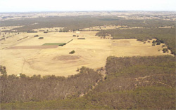
0.02% of CMA region The undulating rises of Quaternary volcanics in the Myrniong and Mount Doran areas are located in the east of the Corangamite catchment. Over 90% of the land here is cleared for private use. The main vegetation classes are Valley Grassy Forest, Heathy Dry Forest and Plains Grassy Woodland. Eucalyptus ovata, E. viminalis, E. rubida and E. obliqua are the dominant species for this basaltic landscape. The weathered basalt has moderate inherent fertility levels and a moderate water holding capacity. In the past the forest has provided sawn timber, posts and firewood. Current land use is mainly grazing and cropping (cereal). Soils of the slopes and plains include acidic and neutral mottled black texture contrast soils. There are minor areas of neutral mottled black texture contrast soils with a conspicuously bleached subsurface horizon, and acidic mottled yellow texture contrast soils. Areas of gilgai microrelief occur where the soils of the mounds and depressions are acidic mottled black texture contrast soils. Neutral black texture contrast soils may occur on gilgai mounds. Sheet and rill erosion, as well as periodic waterlogging, are the main degradation features of these basaltic rises. |  |
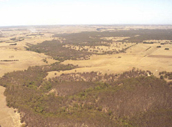 Looking south of Lal La Reservoir towards Mount Doran | 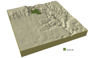 |
|
Component | 1 | 2 | 3 |
Proportion of soil-landform unit | 95% | 3% | 2% |
| CLIMATE Rainfall (mm) | Annual: 690 | ||
| Temperature (oC) | Minimum 7, Maximum 18 | ||
| Precipitation less than potential evapotranspiration | October-March | ||
| GEOLOGY Age and lithology | Quaternary basalt, Orodivician marine shale and sandstone | ||
| Geomorphology | |||
| LANDUSE | Uncleared: Nature conservation; water supply Cleared: Sheep and beef cattle grazing; cropping (cereal) | ||
| TOPOGRAPHY Landscape | Undulating rises | ||
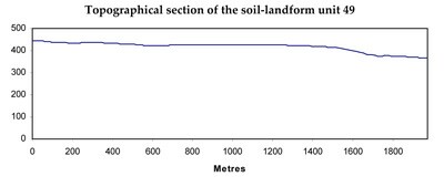
| Elevation range (m) | 391-450 | ||
| Local relief (m) | 2 | ||
| Drainage pattern | Dendritic | ||
| Drainage density (km/km2) | 2.2 | ||
| Landform | Hillslope | Undulating plain | Hillslope |
| Landform element | Long gentle upper slopes | Mounds and depressions | Stony rise |
| Slope and range (%) | 1 (1-3) | 1 (1-2) | 3 (2-5) |
| Slope shape | Straight | Straight | Concave |
| NATIVE VEGETATION Structure | Valley Gressy Forest (7.1%), Heathy Dry Forest (2.8%), Plains Grassy Woodland (0.2%) | ||
| Dominant species | E. ovata, E. viminalis, E. rubida, E. obliqua | ||
| SOIL Parent material | In situ weathered basalt | Alluvium | In situ weathered basalt |
| Description (Corangamite Soil Group) | |||
| Soil type sites | |||
| Surface texture | Clay loam | Clay | Clay loam |
| Permeability | Moderate to low | Moderate | High |
| Depth (m) | 1.5 | 1.5 | 0.5 |
| LAND CHARACTERISTICS, POTENTIAL AND LIMITATIONS | Hardsetting surfaces, dispersible subsoils, and slow permeability results in overland flow and periodic waterlogging. Overland flow inadvertently causes sheet and rill erosion. | Clay soils beside creeks are prone to waterlogging. Streambank undercutting and streambank erosion can occur with excessive rains and inadequate ground coverage. | Overland flow is likely to cause sheet and rill erosion. Nutrient decline is possible due to shallow and permeable soils. |