Victorian Resources Online (archived)
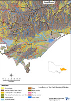
Landform
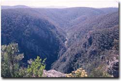 Little River Gorge in the Snowy River National Park |
Geoelogy information
Geoscience Victoria's mapping application allows users to search geospatial databases and display the results as maps or tables. Datasets that can be viewed and interrogated include mineral, petroleum and extractive industries tenements, land-use and airborne geophysical survey boundaries, gravity, magnetic and radiometric images, bore hole & well data, surface geochemistry results, mines and mineral occurrences, and geological and interpretations at various scales.