Victorian Resources Online (archived)
Tubbut (Symbol: Tu)
Geology
Silurian granite.
Landform
The Tubbut map unit encompasses steep hills to steep mountains at an elevation range of about 200 to 800 m and a relief range of up to 500 m. Around Suggan Buggan the area has been arbitrarily subdivided into the Ambyne map unit, which has slopes generally less than 32% and the Tubbut map unit, with slopes generally greater than 32%. A computer generated image of the Suggan Buggan area is shown in the Talbotville section.
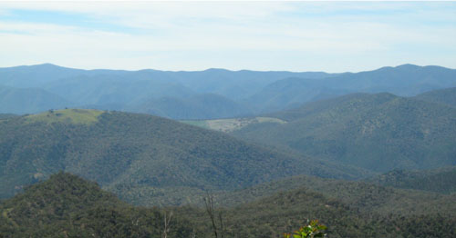
Steep hills and steep mountains with slopes greater than 32% near Suggan Buggan. This photo was taken south west
of Suggan Buggan looking east.
Native vegetation
Grassy woodland, some shrubby dry forest.
Land use
Mostly uncleared.