Victorian Resources Online (archived)
Livingston (Symbol: Lv)
Geology
Mixed colluvium from Palaeozoic granites and associated metamorphic sediments.
Landform
Undulating rises. Typical slopes range from 3-10% with a relief of 9-30 m.
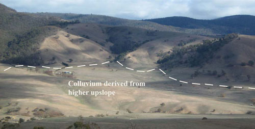
Livingston map unit: moderate to gently inclined slopes in the middle-ground. The steep hills in the background were
elevated by the Livingston Creek Fault, which runs SSW to NNW just west of Omeo. Colluvial sediments have accumulated
below the fault due to erosion of rocks higher up the landscape. The Livingston Creek is in the foreground. This photo was taken from Bald Hills Road.
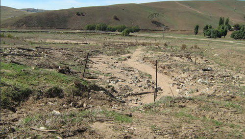
Active colluvial deposition west of Livingston Creek north of Omeo.
| Soils These soils have mostly developed on colluvium derived from the granites and associated metamorphic sediments. It is not possible to give a definite description of these soils as they vary according to the nature of the sediments upslope and the time period since their deposition. As the soils are unconsolidated they are prone to erosion when the soil profile is exposed. Original vegetation Montane dry woodland. Land use Most of the cleared land is used for grazing. | 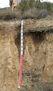 Photo: Road exposure on the Swifts Creek Omeo Road, south of Omeo. |