Victorian Resources Online (archived)
EGRS147
Location: 2 km south of Cann River
Australian Soil Classification: Mottled, Mesotrophic, Brown KUROSOL
Map Unit: Waygara
Previous Site Name: 147
General Landscape Description: Undulating low hills
Site Description: Simple mid slope
Land Use: Native vegetation
Native Vegetation: Lowland forest
Geology: Tertiary sediments
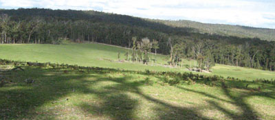
Photo taken on the west side of the Cann River Valley 4 km south of Cann River
Soil Profile Morphology:
| Surface soil | |||
A11 | 0 – 20 cm | Dark greyish brown (10YR4/2); sandy loam; clear change to: | |
A12 | 20 – 60 cm | Brownish yellow (10YR6/6); sandy loam; pH 4.9; clear change to: | |
Subsoil | |||
B2 | 60 – 90 cm | Strong brown (7.5YR5/6), few coarse red mottles; coarse sandy clay; apedal (single grain); pH 4.9; diffuse change to: | |
C | 90 – 110 cm | Strong brown (7.5YR5/6), with few coarse red mottles; sandy clay loam; pH 4.8. | |
Chemical and Physical Analysis:
Horizon | Horizon Depth (cm) | pH (water) | Organic Carbon % | Exchangeable Aluminium ppm | Exchangeable Acididty meq/100g | Exchangeable Cations | |||
Ca | Mg | K | Na | ||||||
meq/100g | |||||||||
A12 | 20-60 | 4.9 | 0.35 | 90 | 6.8 | 0.3 | 1.1 | 0.4 | 0.1 |
B2 | 60-90 | 4.9 | 0.24 | 120 | 6.7 | 0.3 | 1.8 | 0.4 | 0.1 |
C | 90-110 | 4.8 | 0.18 | 110 | 7.2 | 0.3 | 2.5 | 0.5 | 0.1 |
Profile Described By: David Rees, 1989.