Victorian Resources Online (archived)
EGRS219
Location: 6 km south of Combienbar
Australian Soil Classification: Acidic, Dystrophic, Red DERMOSOL
Map Unit: Turton
Previous Site Name: 219
General Landscape Description: Steep hills
Site Description: Upper slope
Land Use: Grazing
Native Vegetation: Shrubby dry forest
Geology: Late Devonian fluvial sediments (conglomerate, sandstone, mudstone)
Soil Profile Morphology:
| Surface soil | 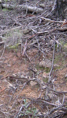 | ||
A11 | 0 – 15 cm | Dark reddish brown (5YR3/2-3); fine sandy loam; moderate granular structure moderately weak consistence; common subangular large sedimentary pebbles; clear change to: | |
A12 | 15 – 30 cm | Dark reddish brown (5YR3/4); fine sandy loam; massive; common subangular large sedimentary pebbles; gradual change to: | |
A3 | 30 – 60 cm | Dark reddish brown (5YR3/4); fine sandy clay loam; weak subangular blocky structure; common angular, sedimentary pebbles; clear change to: | |
| Subsoil | |||
B2 | 60 – 140 cm | Reddish brown (2.5-5YR4/4); silty clay; moderate angular blocky structure; many angular large sedimentary pebbles; gradual change to: | |
B3 | 1.4 m+ | Many angular large sedimentary pebbles increasing with depth. |
Chemical and Physical Analysis:
Horizon | Horizon Depth (cm) | pH (water) | pH (CaCl2) | EC dS/m | Organic Carbon % | Total Nitrogen % | Exchangeable Aluminium ppm | Exchangeable Acididty meq/100g | Exchangeable Cations | |||
Ca | Mg | K | Na | |||||||||
meq/100g | ||||||||||||
A11 | 0-15 | 5.1 | 4.3 | 0.08 | 2.42 | 0.10 | 176 | 16.5 | 1.74 | 1.22 | 0.41 | 0.31 |
A12 | 15-30 | 5.3 | 4.4 | <0.05 | 1.33 | <0.01 | 163 | 12.3 | 0.91 | 1.12 | 0.30 | 0.20 |
A3 | 30-60 | 5.6 | 4.3 | <0.05 | 0.64 | <0.01 | 218 | 10.2 | 0.61 | 1.12 | 0.30 | 0.10 |
B2 | 60-90 | 5.5 | 4.1 | <0.05 | 0.34 | <0.01 | 439 | 11.7 | 0.31 | 1.23 | 0.31 | 0.10 |