Victorian Resources Online (archived)
EGS236
Location: Bendoc North
Australian Soil Classification: Mottled, Eutrophic, Grey CHROMOSOL
Map Unit: Bendoc (Component 2)
Previous Site Name: EG236
General Landscape Description: Undulating to rolling low hills
Site Description: Lower position in the landscape, Lower north-east slope of a low rise, 3% slope
Land Use: Grazing
Geology: Ordovician sediments
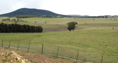
Photo taken 8 km ENE of Bendoc looking towards Mt Delegate
Soil Profile Morphology:
| Surface soil | |||
A1 | 0 – 20 cm | Black (10YR2/1); light clay to clay loam; pH 6.1; abrupt change to: | |
Subsoil | |||
B2 | 20 – 40+ cm | Dark greyish brown (10YR4/2) mottled with yellow brown (10YR5/4); medium to heavy clay; pH 7.2. | |
Chemical and Physical Analysis:
Horizon | Horizon Depth (cm) | pH (water) | pH (CaCl2) | EC dS/m | Exchangeable Acididty meq/100g | Exchangeable Cations | |||
Ca | Mg | K | Na | ||||||
meq/100g | |||||||||
A1 | 0-20 | 6.1 | 5.1 | 0.1 | 13 | 3.6 | 7 | 0.3 | 0.79 |
B2 | 20-40 | 7.2 | 6.2 | 0.08 | 6 | 2 | 8.3 | 0.21 | 0.86 |
Profile Described By: Ian Sargeant, 2011.