Victorian Resources Online (archived)
EGW47
Location: Peppermint Hill
Australian Soil Classification: Bleached, Eutrophic, Grey KUROSOL (gravelly)
Map Unit: Wulgulmerang (Component 1)
Previous Site Name: EG47
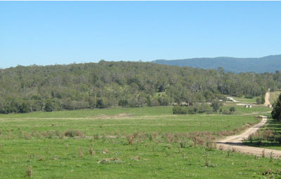
General Landscape Description: Rolling low hills
Site Description: Hill-slope, WNW aspect, 17% slope
Native Vegetation: Montane dry woodland
Geology: Devonian acid volcanics (Snowy River Volcanics)
Soil Profile Morphology:
| Surface soil | 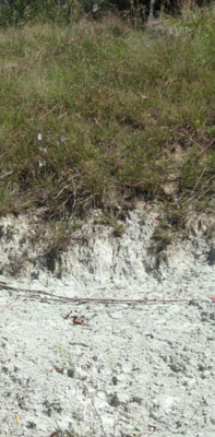 No soil profile photo provided, the road exposure opposite is near the Gelantipy Bush Nursing Centre | ||
| A1 | 0 – 10 cm | Very dark greyish brown (10YR3/2); sandy loam; weak medium polyhedral structure; weak consistence, moderately moist; common subrounded small gravel; clear change to: | |
| A2 | 10 – 45 cm | Pale brown (10YR6/3) conspicuously bleached (10YR7/2d); silty loam with coarse sand; massive; very firm consistence dry; many subrounded small gravel, abrupt change to: | |
| Subsoil | |||
| B2 | 45 – 60 cm | Light brownish grey (10YR6/2); medium clay; strong coarse prismatic structure; very firm moist; pH 5.2. |
Key Profile Features:
- Strong texture contrast between the surface (A1, A21 and A22) horizons and the subsoil (B2) horizon.
- Conspicuously bleached subsurface (A21 and A22) horizons that are hard setting.
Chemical and Physical Analysis:
Horizon | Horizon Depth (cm) | pH (water) | pH (CaCl2) | EC dS/m | Exchangeable Aluminium ppm | Exchangeable Acididty meq/100g | Exchangeable Cations | Coarse Sand (0.2-2.0 mm) % | Fine Sand (0.02-0.2 mm) % | Silt (0.002-0.02 mm) % | Clay (<0.002 mm) % | Field Capacity % w/w | Wilting Point % w/w | |||
Ca | Mg | K | Na | |||||||||||||
meq/100g | ||||||||||||||||
B2 | 45-60 | 5.2 | 4.2 | 0.08 | 410 | 12.0 | 2.8 | 5.2 | 0.37 | 0.46 | 10 | 22 | 24 | 39 | 37.7 | 20.5 |
Management Considerations
- The ‘B’ horizon is strongly acid with very high levels of exchangeable aluminium (410 ppm). This indicates aluminium and manganese toxicity may occur and restrict the growth of aluminium sensitive species such as lucerne. There should be long term benefits of applying lime, preferably incorporated, on this site if the test results are representative of the paddock. A pH/aluminium test is, however, best performed from samples taken across the paddock and bulked together. Other factors need to be considered, however, before lime is recommended (eg. pasture species grown, method of application, local trial responses, soil surface structure and likely cost/benefit).
Profile Described By: David Rees and Grant Boyle, 2000.