Victorian Resources Online (archived)
EGW84
Location: Gelantipy
Australian Soil Classification: Ferric, Eutrophic, Grey CHROMOSOL (thick surface)
Map Unit: Gelantipy (Component 2)
Previous Site Name: EG84
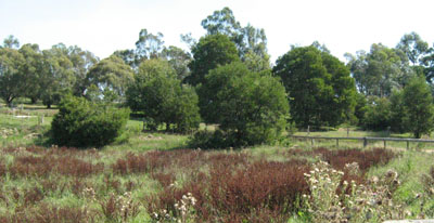
General Landscape Description: Plateau
Site Description: Upper slope, ENE aspect, 11 % slope
Land Use: Unused
Native Vegetation: Montane grassy woodland
Geology: Tertiary basalt
Soil Profile Morphology:
| Surface soil | 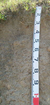 | ||
| A1 | 0 – 5 cm | Dark greyish brown (10YR4/2); silty loam; weak crumb structure; firm consistence dry; few medium ferruginous concretions; gradual change to: | |
| A21 | 5 – 50 cm | Greyish brown (10YR5/2); silty loam; massive; very firm consistence dry; few medium ferruginous concretions; pH 6.1; clear wavy change to: | |
| A22 | 50 – 60 cm | Greyish brown (10YR5/2); silty loam; massive; strong consistence dry; many medium ferruginous concretions; clear wavy change to: | |
| Subsoil | |||
| B2 | 60 – 100+ cm | Grey (10YR5/1) finely mottled with brownish yellow (10YR6/6); heavy clay; strong coarse prismatic structure, very strong consistence dry; very many (>50%) medium to coarse ferruginous concretions and many rounded basalt stones; pH 6.7. |
Key Profile Features:
- Strong texture contrast between surface (A) horizon and subsurface (B2) horizon.
Soil Profile Characteristics:
| - | pH | Salinity | ||
Surface soil (A1 horizon) | Slightly acidic | Very low | Non sodic | None1 |
Subsoil (B2 horizon) | Slightly acidic | Very low | Non sodic | None2 |
Chemical and Physical Analysis:
Horizon | Horizon Depth (cm) | pH (water) | pH (CaCl2) | EC dS/m | Organic Carbon % | Total Nitrogen % | Free Fe2O3 % w/w | Exchangeable Aluminium ppm | Exchangeable Acididty meq/100g | Exchangeable Cations | Coarse Sand (0.2-2.0 mm) % | Fine Sand (0.02-0.2 mm) % | Silt (0.002-0.02 mm) % | Clay (<0.002 mm) % | Field Capacity % w/w | Wilting Point % w/w | |||
Ca | Mg | K | Na | ||||||||||||||||
meq/100g | |||||||||||||||||||
A2 | 5-50 | 6.1 | 5.3 | <0.05 | 0.76 | <0.05 | 2.2 | <1 | 6.4 | 2.8 | 1.3 | 0.07 | 0.11 | 9 | 41 | 30 | 16 | 27.9 | 6.4 |
B2 | 60-100 | 6.7 | 6.2 | <0.05 | 4.1 | 7.6 | 8.1 | 12 | 0.14 | 0.74 | 8 | 24 | 22 | 46 | 42.4 | 22.4 | |||
Management Considerations
Whole profile
- The profile is slightly acid throughout
- Plant roots would find it difficult to penetrate the massive subsurface (A21 and A22) horizons which would be hard setting when dry
- Plant available water capacity is considered to be low; estimated at 57 mm.
Surface (A) horizons
- The nutrient holding capacity of the soil is low (based on the sum of the exchangeable basic cations and the depth of roots observed)
- Potassium levels are very low and a response to potassium would be expected.