Victorian Resources Online (archived)
GRES398
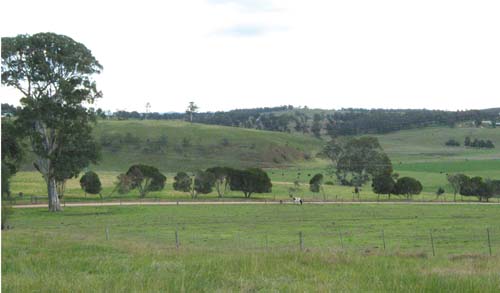
Location: Wy Yung
Australian Soil Classification: Haplic, Lithocalcic, Red DERMOSOL
Previous Site Name: AL13
General Landscape Description: Valley slopes up to 32%
Site Description: Midslope of a low hill, 14% slope
Native Vegetation: Dry valley forest
Geology: Complex of Neogene limestone (Miocene) and alluvial sediments (Pleistocene)
 |
Soil Profile Morphology:
| 0 – 15 cm | Dark reddish brown; light clay; pH 6.3. | 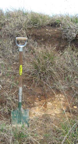 Roadside cutting on the Wy Yung Calulu Road near Calulu | |
| 15 – 40 cm | Red; heavy clay; pH 6.8; | ||
| 40 – 90 cm | Red; medium clay; pH 7.5. |
Chemical and Physical Analysis:
Horizon Depth (cm) | pH (water) | Organic Carbon % | Total Nitrogen % | Exchangeable Cations | Gravel % | Coarse Sand (0.2-2.0 mm) % | Fine Sand (0.02-0.2 mm) % | Silt (0.002-0.02 mm) % | Clay (<0.002 mm) % | |||
Ca | Mg | K | Na | |||||||||
meq/100g | ||||||||||||
0-10 | 6.3 | 4.8 | 0.37 | 15.9 | 2.3 | 1.3 | 0.2 | 2 | 7 | 37 | 14 | 38 |
30-60 | 6.8 | 27.3 | 1.8 | 0.5 | 0.5 | 4 | 2 | 8 | 3 | 86 | ||
80-90 | 7.5 | 29.7 | 1.3 | 0.4 | 0.4 | 6 | 7 | 10 | 9 | 72 | ||
Profile Described By: J.M. Aldrick, 1978.