GL27
Location: Bahgallah
Australian Soil Classification: Parapanic, Homosesquic, Semiaquic PODOSOL (confidence level 3)
General Landscape Description: Dune
Site Description: Lower slope
Land Unit: Follet Dunes and Plains
Geology: Quaternary aeolian
General Land Unit Description: The majority of this land unit falls south of the Kanawinka fault. This land unit comprises areas with deep sand deposits. The residual landscape is thought to be influenced by the retreat of the Murray Sea which left stranded beach ridges oriented south west–north east. These were subsequently covered by superficial sand sheets in later depositional phases, which formed the landscape seen today.
The major landforms in this land unit are dunes and swales. Podosols and Kurosols or Chromosols are the major soil types found on the dunes and rises. Podosols are soils with a ‘coffee rock’ layer (refer to photograph). The Kurosols or Chromosols tend to have a deep sandy topsoil over the clay. The common soil types on the swales are black cracking clay (Vertosols) or Grey Sodosols. Some Ferric Kurosols or Chromosols can also occur on the swales or lower slopes of the dunes.
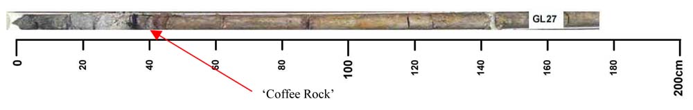
Key profile features:
- Sandy topsoil
- 'Coffee rock' horizon
- Strong texture contrast between topsoil and subsoil
Profile Described By: Natalie Baxter and Grant Boyle, 2nd October 2000.