Follet Dunes and Plains Land Unit
The majority of this land unit falls south of the Kanawinka Fault. This land unit comprises areas with deep sand deposits. The residual landscape is thought to be influenced by the retreat of the Murray Sea which left stranded beach ridges oriented south-west/north-east. Superficial sand sheets subsequently covered these in later depositional phases, which formed the landscape seen today.
The major landform in this land unit is undulating plains with sandy rises (or dunes) and swales between the rises. When uncleared, the vegetation commonly marks the distinct changes from a landscape comprising deep sand to one of shallow sand. The major tree species on the deep sand is Brown Stringybark, with an understorey of heath vegetation, such as Blackboys and Tea trees. Yellow Gums prefer the shallower sandy topsoils. Podosols and Kurosols, or Chromosols with a deep topsoil are the major soil types found on the dunes and rises. The common soil types on the swales are black cracking clays (Vertosols) or Grey Sodosols. Some Ferric Kurosols or Chromosols can also occur in the swales or lower slopes of the dunes.
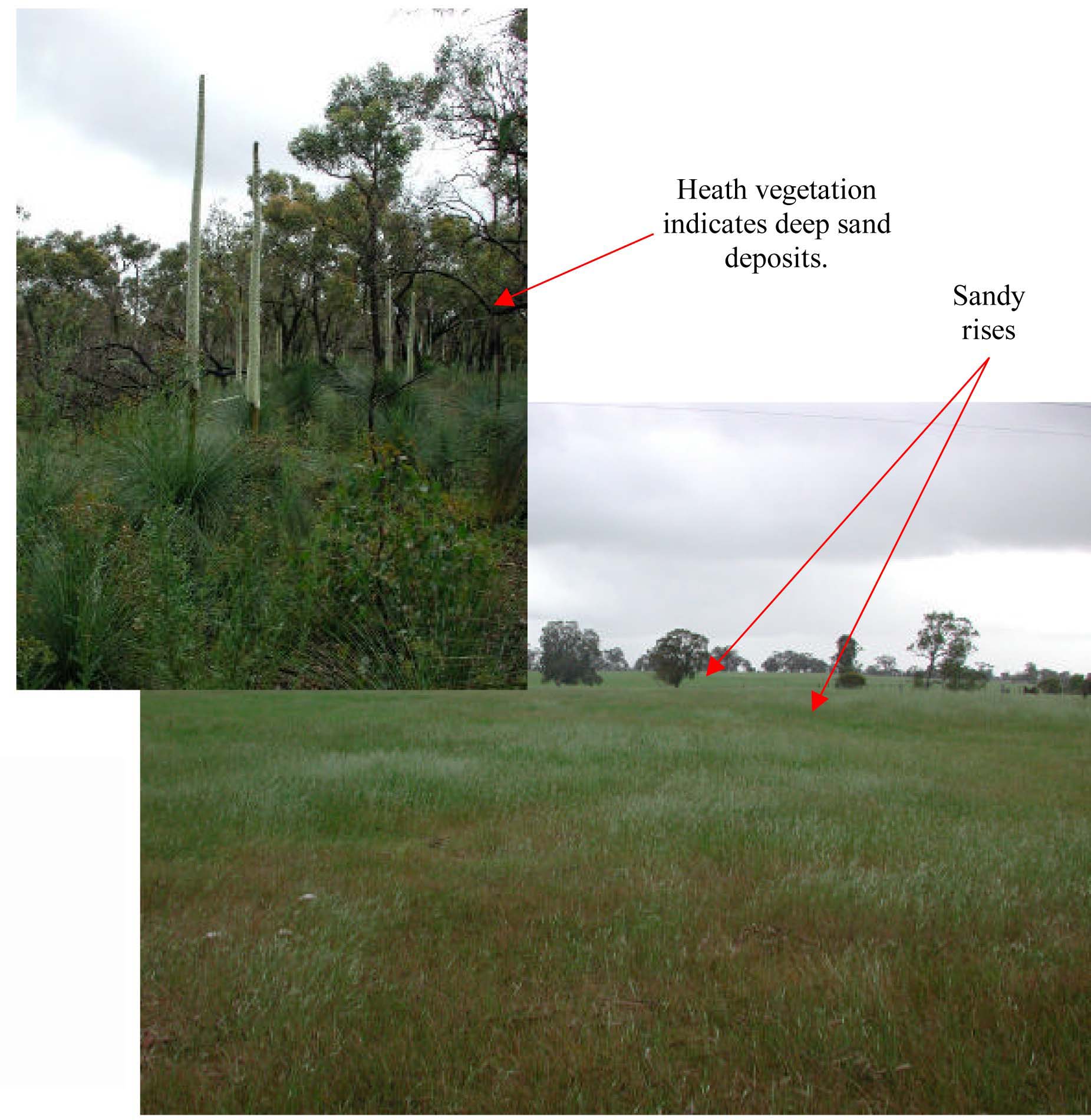
Plates 26 & 27 Sandy rises (historic dunes) of the Follet Dunes and Plains Land Unit located south of Harrow.