Victorian Resources Online (archived)
GL122
| Site: GL122 | Land Unit: Glenelg River Granite |
| Aust. Soil Class.: Eutrophic, Mottled-Subnatric, Black SODOSOL (confidence level 1) | |
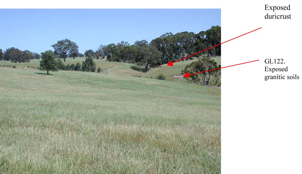
| General Land Unit Description: In the steeper dissected valleys of the tablelands, where the duricrust has been eroded, weathered parent material becomes exposed. This example is of highly weathered granite. This site illustrates the range of soil types and parent material that have been exposed due to weathering of the tablelands and highlights the difficulty of mapping all the geologies and soil types at this scale. 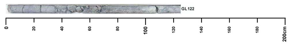 |
Site Description:
| Slope: 3% | Geology: Ordovician granite |
| Landform pattern: Low hills | Position in landscape: Lower slope / drainage depression |
| Internal drainage: Imperfectly drained |
| A11 | 0-10 cm | Black (10YR2/1) coarse sandy clay loam, weak subangular blocky structure (5-10 mm), pH 5.4. Transition to: |
| A12 | 10-25 cm | Black (10YR2/1) coarse sandy clay loam, massive structure, pH 5.4. Transition to: |
| A2 | 25-40 cm | Very dark grey (10YR3/1) loamy coarse sand, sporadically bleached, grey (10YR6/1) when dry, massive structure, pH 5.9; transition to: |
| Subsoil | ||
| B21 | 40-80 cm | Very dark greyish brown (10YR3/2), sandy medium heavy clay, many distinct orange mottles, massive subangular blocky structure (5-10 mm), pH 5.6. Transition to: |
| B22 | 80-140 cm | Dark greyish brown (2.5Y3/2), sandy medium heavy clay, weak to massive structure, segregations and weathered kaolinite fragments are abundant, pH 5.9. |
Key profile features:
- Acidic topsoil
- Sodic topsoil
- Mottled subsoil
- Topsoil dispersive when worked when wet
- Subsoil dispersive when dry