Victorian Resources Online (archived)
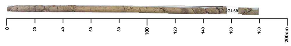
GL69
| Site: GL69 | Land Unit: Marl |
| Aust. Soil Class.: Vertic, Petrocalcic, Brown CHROMOSOL (confidence level 3) | |
 | General Land Unit Description: This land unit is a complex consisting of mainly gently undulating to level plains with numerous small depressions. In the more undulating portion of the unit, the very slight rises with broad level crests have soils consisting of Dermosols (GL98) or Chromosols (GL70). The soils are variable, some soils have soft carbonate nodules at depth, some soils have ferruginous nodules and some soils exhibit vertic (cracking) characteristics. There are also minor occurrences of sand hills and dunes consisting of deep, uniform sands (Podosols). The numerous small depressions are commonly alkaline grey or black cracking clays (Vertosols). A minor soil type in some depressions are acidic black cracking clays (Vertosols) and some shallow soils. The soils in the western portion of the land unit tend to have poorer internal drainage compared to those in the eastern zone. The major restriction for land use is the poor internal drainage and the variable soils within a short distance. This soil type is a minor soil type on the plains of this land unit. |
Site Description:
| Geology: Tertiary marl | Landform pattern: Gently undulating plains |
| Position in landscape: Lower slope | Internal drainage: Imperfectly drained |
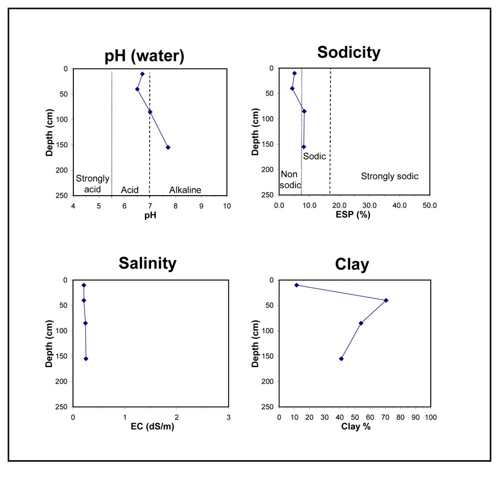
Key profile features:
- Strong texture contrast between topsoil and subsoil
- Subsoil cracks
- Calcium carbonate at depth
- Sodic subsoil