Victorian Resources Online (archived)
GL7
| Site: GL7 | Land Unit: Dissected Slates |
| Aust. Soil Class.: Mottled, ?, Brown CHROMOSOL (confidence level 3) |
 |
General Land Unit Description: This land unit covers a small area of dissected slopes leading to the Glenelg River and its tributaries, as well as a small area adjacent to Rocklands Reservoir. The most common landform is undulating rises, although there are some gentler slopes coming off the rises. There is also a small patch of low hills that have not been mapped due to restrictions of scale. This area would have a lower capability for land use options due to slope, soil and rock outcrop restrictions. |
Site Description:
| Geology: Cambrian schists | Landform pattern: Undulating rises |
| Position in landscape: Lower slope | Internal drainage: Moderately well drained |
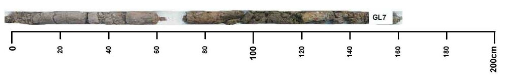
Soil Profile Morphology
| A11 | 010 cm | Very dark brown (10YR2/2) loamy sand, weak subangular blocky structure (2-10 mm), weak consistence when dry, pH 6. Transition to: |
| A12 | 10-30 cm | Very dark grey (10YR3/1) loamy sand, massive structure, firm consistence when dry, pH 6. Transition to: |
| Subsoil | ||
| B21 | 60-70 cm | Brown (10YR4/3) light clay, many faint orange and yellow mottles, moderate to weak subangular blocky structure (2-10 mm), very firm consistence when dry, many medium rounded to ferruginous nodules, pH 7. Transition to: |
| B22 | 70-120 cm | Light olive brown (2.5Y5/4) medium heavy clay, many distinct orange and yellow mottles, moderate subangular blocky structure, pH 6.5. Transition to: |
| BC | 120-150+ cm | Grey, medium heavy clay, many prominent orange and red mottles. |