Victorian Resources Online (archived)
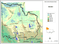
Elevation
|
This elevation map provides a broadscale overview of the relief across the region. It was created from the DEM250 dataset in the DSE Corporate Geospatial Data Library. This in turn was derived from an AUSLIG Digital Elevation Model of spot heights from 1:100 000 mapsheets and interpolated into a 500 metre cell size grid. |
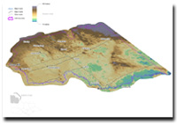
Mallee 3D Elevation