Victorian Resources Online (archived)
Land Use
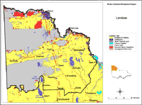 Mallee Landuse | This map is based on general statewide information obtained by satellite image interpretation (1991) and from other statewide datasets. It was initially prepared for State of Environment reporting in 1991and provides a general indication only, of land use and land tenure across the Mallee region. Data used to generate this map was derived from the land use layer (LANDUSE250) of the DPI/DSE Corporate Geospatial Data Library. | 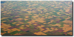 Cropping in the southern Mallee (November 2003) |