Victorian Resources Online (archived)
Declared Water Supply Catchments - North East
Back to: North East Declared Water Supply Catchments
This is a clickable map. Click on DWSC in Legend for detailed information.
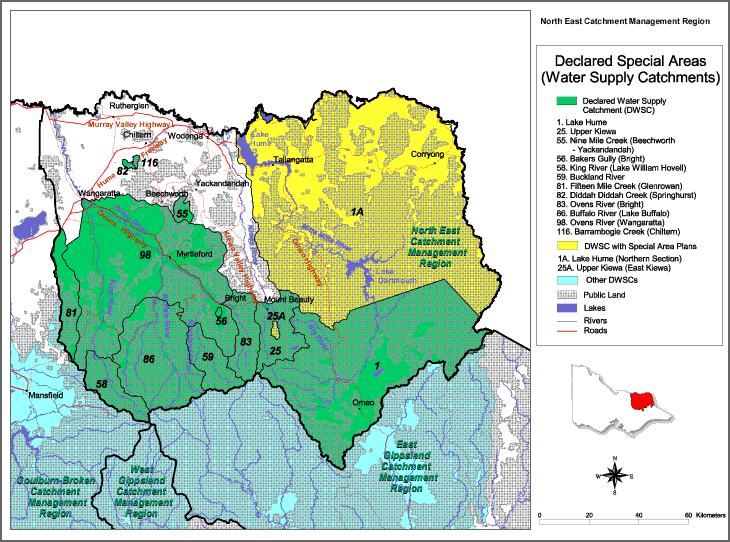
| Declared Water Supply Catchments | Special Area Plans | |
| 1. Lake Hume | 82. Diddah Diddah Creek (Springhurst) | 1A. Lake Hume (Northern Section) |
| 25. Upper Kiewa | 83. Ovens River (Bright) | 25A. Upper Kiewa (East Kiewa) |
| 55. Nine Mile Creek (Beechworth - Yackandandah) | 86. Buffalo River (Lake Buffalo) | |
| 56. Bakers Gully (Bright) | 98 Ovens River (Wangaratta) | |
| 58. King River (Lake William Howell) | 116. Barrambogie Creek (Chiltern) | |
| 81. Fifteen Mile Creek (Glenrowan) | ||