Victorian Resources Online (archived)
Archived content — This page contains material from the Victorian Resources Online (VRO) website. It is no longer maintained and is provided for reference only. This content is hosted by CeRDI and is not endorsed by Agriculture Victoria.

Sitemap

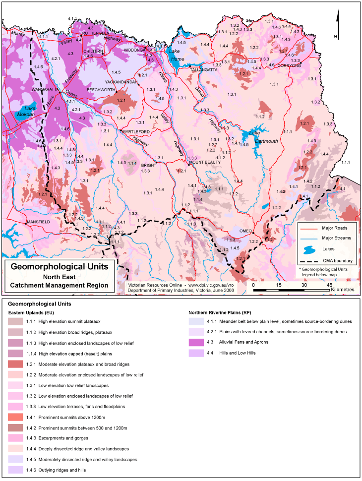
North East Geomorphological Units

Back to: North East - Geomorphology

This is a clickable map. Click on Land Unit in Legend for more information.

North East Geomorphological Unit

Geomorphological Units
Eastern Uplands (EU)1.4.3 Escarpments and gorges
1.1.1 High elevation summit plateaux1.4.4 Deeply dissected ridge and valley landscapes
1.1.2 High elevation broad ridges, plateaux1.4.5 Moderately dissected ridge and valley landscapes
1.1.3 High elevation enclosed landscapes of low relief1.4.6 Outlying ridges and hills
1.1.4 High elevation capped (basalt) plains
1.2.1 Moderate elevation plateaux and broad ridgesNorthern Riverine Plains (RP)
1.2.2 Moderate elevation enclosed landscapes of low relief4.1.1 Meander belt below plain level, sometimes source-bordering dunes
1.3.1 Low elevation low relief landscapes4.2.1 Plains with leveed channels, sometimes source-bordering dunes
1.4.1 Prominent summits above 1200 m4.3 Alluvial fans and aprons
1.4.2 Prominent summits between 500 and 1200 m4.4 Hills and low hills