Victorian Resources Online (archived)
EGW59
Location: Omeo West
Australian Soil Classification: Bleached, Eutrophic, Red Chromosol
Map Unit: Minor map unit A
Previous Site Name: EG59
General Landscape Description: Alluvial terrace
Site description: Alluvial terrace, Simple slope, gradient unspecified
Land Use: Grazing on annual pasture
Native Vegetation: Montane grassy woodland
Geology: Pleistocene (Neogene) alluvium and colluvium.
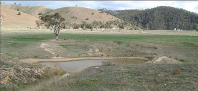
Alluvial terrace near where soil samples were taken. The Livingston Fault formed the steep hills in the background.
No soil pit photo available, but the deep profile exposed in the first photo serves as an indication.
Soil Profile Morphology:
| Surface soil | ||
A1 | 0 – 10 cm | Dark brown (10YR4/3); fine sandy loam; weak polyhedral structure; pH 5.3; clear change to: |
| A2 | 10 - 20 cm | Pinkish grey (7.5YR6/3); conspicuously bleached (7.5YR7/2d); fine sandy loam; apedal; very firm consistence, dry; pH 5.4; clear change to: |
Subsoil | ||
| B21 | 20 – 40 cm | Reddish brown (5YR4/4); medium clay; strong angular blocky structure; strong consistence dry; common (10 – 20%) medium (6 – 20 mm) rounded pebbles; pH 5.5; clear change to: |
| B22 | 40 – 60+ cm | Reddish brown (5YR4/4); medium clay; weak angular blocky structure; strong consistence dry; common abundant medium (6 – 20 mm) and large (20 – 60 mm) pebbles. |
Key Profile Features:
- Strong texture contrast between the surface soils (A1 and A2 horizons).
- High amounts of gravel in the subsoil.
Soil Profile Characteristics:
- | pH | Salinity | ||
Surface soil (A1 horizon) | Strongly Acid | Very Low | Non-sodic | None# |
Subsoil (B1 horizon) | Strongly Acid | Very Low | Non-sodic | None# |
Deeper subsoil (70 -110 cm) | Strongly Acid | Very Low | Non-sodic | None* |
Chemical and Physical Analysis:
Horizon | Horizon Depth (cm) | pH (water) | pH (CaCl2) | EC dS/m | Organic Carbon % | Total Nitrogen % | Exchangeable Aluminium ppm | Exchangeable Acididty meq/100g | Exchangeable Cations | Coarse Sand (0.2-2.0 mm) % | Fine Sand (0.02-0.2 mm) % | Silt (0.002-0.02 mm) % | Clay (<0.002 mm) % | Field Capacity % w/w | Wilting point % w/w | |||
Ca | Mg | K | Na | |||||||||||||||
meq/100g | ||||||||||||||||||
A1 | 0-10 | 5.3 | 4.6 | 0.09 | 2.1 | 0.14 | 4.6 | 8.3 | 2.4 | 2.0 | 0.73 | 0.1 | 24 | 38 | 14 | 22 | 21.6 | 8.0 |
A2 | 10-20 | 5.4 | 4.7 | 0.05 | 13 | 4.5 | 1.4 | 0.91 | 0.35 | 0.06 | 23 | 46 | 18 | 13 | 18.3 | 4.4 | ||
B21 | 20-40 | 5.5 | 4.8 | 0.11 | 35 | 12.0 | 6.2 | 6.5 | 0.95 | 0.36 | 9 | 14 | 6 | 66 | 35.1 | 21.0 | ||
Management Considerations
Whole profile
- The soil shows marked texture contrast between the surface soil and the subsoil.
- Plant available water content is moderate, based on a root depth of 50 cm. The dense and coarsely structured subsoil is likely to restrict root growth and confine most of the roots to the surface soil.
- Roots will be impeded by the very stony subsoil.
- The soil profile is strongly acid throughout.
- The whole profile has very low amounts of soluble salts.
- The low wilting points (8.0 and 4.4 %) of the surface soils indicates the plants are able to utilize very light rains when the soil is dry. However, due to the low water storage capacity, plants will soon suffer moisture stress unless further rains occur.
- The surface soils are strongly acid. However the level of exchangeable aluminium is low and is unlikely to affect the growth of aluminium sensitive species, except the most sensitive. Lime can be used to increase soil pH but a pH/aluminium test is best performed by taking samples across the paddock and bulked together. The use of test strips to observe lime response could be used as an aid in evaluating its cost/benefit. For this soil a response to lime (about 2 tonnes/ha) would be expected.
- The organic matter content of the soil is low for such a high rainfall area. Such levels result in a low structural condition and low structural stability. Careful pasture management is needed to increase organic matter levels.
- Potassium is high and no response to potassium fertilisers would be expected.
- The nutrient status of the surface (A1 and A2) horizons is low (based on the sum of the exchangeable calcium, magnesium, potassium and sodium cations). The addition of lime will increase the Ca:Mg ratio and the exchangeable calcium.
- The bleached subsurface layer lacks structure, sets hard when dry, impedes plant growth and slakes partially when wet.
- The strongly structured clay subsoil is non-sodic and does not disperse. These soils appear to be strongly structured which should allow good root penetration.
- Root movement is likely to be restricted in the gravelly deep subsoil. Reddish colours indicate the soil is well drained internally.
Profile Described By: I.P. Little and W.T. Ward 1977.