Victorian Resources Online (archived)
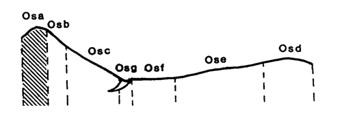
Marong map unit Osa
Back to: A Land Capability Study of the Rural City of Marong
| Map Unit: | Ordovician sediments, crest/ridge | Map Unit Symbol: | Osa |
| % of Study Area: | 0.2 |
General Description:
The crest/ridge line of the metamorphic aureole represents only a small area of the Rural City. The soils are uniform fine sandy loams with slight Increases in clay content in the subsoil. The soils are dark grey-brown, shallow and have many angular metamorphic fragments throughout the profile and on the soil surface. Bedrock occasionally outcrops.
Site characteristics:
| Parent material age: | Ordovician | Depth seasonal watertable: | > 10 m |
| Lithology: | Sediments | Potential recharge to groundwater: | Very high |
| Landform Pattern: | Rolling hills | Flooding risk: | Nil |
| Element: | Crest | Drainage: | Rapidly drained |
| Slope common: | 0% | Depth to hardrock: | 0.36 m |
| Slope range: | 0 - 2% | ||
| Rock outcrop: | < 2% |
Present land use: Park, native forest
| Land degradation: | Water erosion | Wind erosion | Salting | Acidification | |
Sheet/rill | Gully | ||||
| Susceptibility | Moderate | Very low | Low | Low | Low |
| Incidence | Moderate | Low | Low | Low | Low |
Soil profile characteristics:
| Permeability (measured - average, range): | 4705 1761 - 5904 mm/day |
| Permeability (estimated): | - |
| Available water capacity: | 57.6 mm H2O |
| Linear shrinkage (B horizon): | 1.6% |
Soil profile description:
| A | 0-17 cm | Brownish black (10YR 2/2) fine sandy loam, weak structure, subangular blocky peds less than 2 mm, rough fabric, very weak consistence, abundant angular metamorphic cobbles and stones, pH 5.2. Gradual transition to |
| B | 17-36 cm | Greyish brown (7.5YR4/2) fine sandy loam, weak structure, subangular blocky peds 2-5 mm, rough fabric, moderately weak consistence, less than 2% organic segregations, abundant angular metamorphic cobbles and stones. pH 5.3. |
| C | 36 cm | Rock |
Soil classification:
| Factual Key (Northcote): | Uc 6.1 (major) Um5.51 (minor) |
| Australian Soil Classification: | Acidic, Mellic, Grey, Kandosol; shallow, medium loamy, very gravelly |
| Unified Soil Group: | GM |
Interpretation of soil analyses*
Horizon | pH | Gravel % | E.C. (salts) | Nutrient Status | P | K | Al | Organic Matter | Dispersibility |
| A | 5.2** | 68.9 | VL | VL | D | S | T | H | L |
| B | 5.3** | 57.1 | VL | VL | D | S | T | H | L |
Land capability assessment
Land Use | Class | Major limiting feature(s)/ landuse |
| Agriculture (CTS values) | C3T1S5 | Very high gravel/stone/boulder content,shallow depth to hardrock |
| Effluent disposal (septic tanks) | 5 | Shallow depth to hardrock, excessive permeability – risk of polluting groundwater |
| Farm dams (earthen) | 5 | Shallow depth to hardrock, very low suitability of subsoil, excessive permeability |
| Building foundations - slab | 4 | Shallow depth to hardrock |
| Building foundations - stumps/footings | 4 | Shallow depth to hardrock |
| Secondary roads | 4 | Shallow depth to hardrock |
| Urban residential | 4 | Secondary roads, building foundations |
| Rural residential | 5 | Farm dams, effluent disposal |
The high resolution PDF file provided on this page can be viewed using the free Adobe PDF reader, this software can be installed for free from the Adobe website (external link).
A Land Capability Study of the Rural City of Marong - map unit Osa - (PDF - 38.3 KB)