Victorian Resources Online (archived)
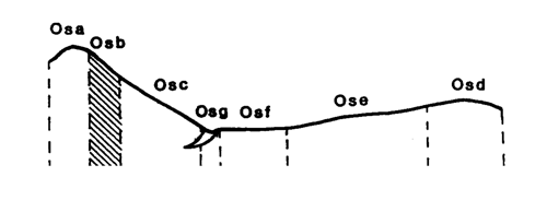
Marong map unit Osb
Back to: A Land Capability Study of the Rural City of Marong
| Map Unit: | Ordovician sediments, steep slope | Map Unit Symbol: | Osb |
| % of Study Area: | 0.2 |
General Description:
This unit is located on the steep upper slopes of the metamorphic aureole (Big Hill Range). The soils are very similar to those on the aureole crests; shallow dark grey brown stony loams. The variation being that the soils on the steep slopes tend to be slightly deeper. Surface coarse fragments are common.
Site characteristics:
| Parent material age: | Ordovician | Depth seasonal watertable: | > 5 m |
| Lithology: | Sediments | Potential recharge to groundwater: | Very high |
| Landform Pattern: | Rolling Hills | Flooding risk: | Nil |
| Element: | Upper slopes | Drainage: | Rapidly drained |
| Slope common: | 33% | Depth to hardrock: | 0.5 m (variable) |
| Slope range: | 30 - 40% | ||
| Rock outcrop: | 2 - 10% |
Major vegetation: Grey Box, Red Ironbark, Buloke, Golden Wattle, Red Stringybark, Hedge Wattle, Cat's Claw Grevillea, Black-anther Flax-lily, Tall Rapswort, Spear Grass, Wallaby Grass, Native bulbs.
Present land use: Native forest, park
| Land degradation: | Water erosion | Wind erosion | Salting | Acidification | |
Sheet/rill | Gully | ||||
| Susceptibility | Very high | Very low | Low | Low | Low |
| Incidence | Moderate | Low | Nil | Nil | Low |
Soil profile characteristics:
| Permeability (measured - average, range): | 4705, 1761 - 5904 mm/day |
| Permeability (estimated): | - |
| Available water capacity: | 95 mm H2O |
| Linear shrinkage (B horizon): | 1.6% |
Soil profile description:
| A1 | 0-17 cm | Brownish black (10YR2/2) fine sandy loam, weak subangular blocky peds less than 2 mm, rough fabric, very weak consistence, abundant angular metamorphic cobbles and stones, pH 5.2. Gradual transition to |
| B | 17-50 cm | Greyish brown (7.5YR4/2) fine sandy loam, weak structure, subangular blocky peds 2-5 mm, rough fabric, moderately weak consistence, less than 2% organic segregations, abundant angular metamorphic cobbles and stones, pH 5.3. |
| C | 50 cm | Rock |
Soil classification:
| Factual Key (Northcote): | Uc 6.1 (major) Um5.51 (minor) |
| Australian Soil Classification: | Acidic, Mellic, Grey, Kandosol; moderate, medium, loamy, very gravelly |
| Unified Soil Group: | GM |
Interpretation of soil analyses*
Horizon | pH | Gravel % | E.C. (salts) | Nutrient Status | P | K | Al | Organic Matter | Dispersibility |
| A | 5.2** | 68.9 | VL | VL | D | S | T | H | L |
| B | 5.3** | 57.1 | VL | VL | D | S | T | H | L |
Land capability assessment
Land Use | Class | Major limiting feature(s)/ landuse |
| Agriculture (CTS values) | C3T5S5 | Steep slope, very high gravel/stone/boulder content, very susceptible to sheet erosion |
| Effluent disposal (septic tanks) | 5 | Steep slope, excessive permeability – risk of polluting groundwater |
| Farm dams (earthen) | 5 | Steep slope, very low suitability of subsoil, shallow depth to hardrock, excessive permeability |
| Building foundations - slab | 5 | Steep slope |
| Building foundations - stumps/footings | 4 | Steep slope, high risk of slope failure, shallow depth to hardrock |
| Secondary roads | 5 | Steep slope |
| Urban residential | 5 | Secondary roads, building foundations (slab) |
| Rural residential | 5 | Farm dams, effluent disposal, secondary roads, building foundations (slab) |
The high resolution PDF file provided on this page can be viewed using the free Adobe PDF reader, this software can be installed for free from the Adobe website (external link).
A Land Capability Study of the Rural City of Marong - map unit Osb - (PDF - 38 KB)