Victorian Resources Online (archived)
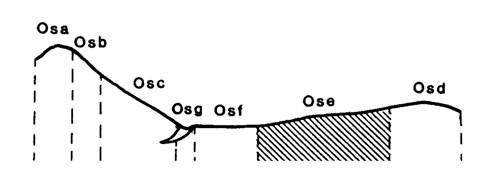
Marong Map unit Ose
Back to: A Land Capability Study of the Rural City of Marong
| Map Unit: | Ordovician sediments, gentle slope | Map Unit Symbol: | Ose |
| % of Study Area: | 17.1 |
General Description:
This unit is widespread throughout the centre of the study area. The dominant soil types are red duplex with hardsetting fine sandy loam topsoils and sporadically bleached A2 horizons. Yellow mottling occurs occasionally in the medium clay subsoils. Soil variations include fully bleached A2 horizons and gradational yellow brown soils with sporadically bleached A2 horizons. Coarse fragments are common throughout the profile and on the soil surface. The soils are very similar to those on the very gentle slopes and gentle crests and detailed information has been extrapolated from those sites.
Site characteristics:
| Parent material age: | Ordovician | Depth seasonal watertable: | > 5 m |
| Lithology: | Sediments | Potential recharge to groundwater: | Low |
| Landform Pattern: | Undulating low hills | Flooding risk: | Nil |
| Element: | Slope | Drainage: | Well drained |
| Slope common: | 5% | Depth to hardrock: | 0.8 m |
| Slope range: | 3 - 10% | ||
| Rock outcrop: | 0% |
Major vegetation: Grey Box, Red Box, Yellow Gum, Golden Wattle, Gold-dust Wattle, Hedge Wattle, Round-leaf Wattle, Black-anther Flax-lily, Drooping Cassinia, Spear Grass, Onion Grass
Present land use: Native forest, grazing, residential
| Land degradation: | Water erosion | Wind erosion | Salting | Acidification | |
Sheet/rill | Gully | ||||
| Susceptibility | High | High | Low | Low | Moderate |
| Incidence | Low | Moderate | Low | Nil | Moderate |
Soil profile characteristics:
| Permeability (measured - average, range): | 37, 15 - 88 mm/day |
| Permeability (estimated): | - |
| Available water capacity: | 122 mm H20 |
| Linear shrinkage (B horizon): | 14.6 % |
Soil profile description:
| A1 | 0-12 cm | Dull reddish brown (5YR4/3) fine sandy loam, weak structure, subangular blocky peds 2 - 5 mm, smooth fabric, moderately firm consistence, common subangular sedimentary and quartz gravel fragments, moderate organic matter, pH 6.2. Clear transition to |
| A2 | 12-30 cm | Hardsetting orange (5YR6/6) loam fine sandy, sporadically bleached when dry, weak structure, subangular blocky peds 5-10 mm, smooth fabric, moderately firm consistence, a few organic segregations, many angular coarse sedimentary fragments, pH 4.7. Clear transition to |
| B2 | 30-60 cm | Dull reddish brown (5YR4/4) medium clay, weak structure, subangular blocky peds 10 - 20 mm, smooth fabric, very firm consistence, pH 7.3. Gradational transition to |
| B3 | 60-80 cm | Dull reddish brown (5YR4/4) medium clay, moderate structure, subangular blocky peds 5 - 10 mm, smooth fabric, moderately firm consistence, many subangular sedimentary gravel fragments, pH 9.0. Clear transition to |
| C | 80 cm | Rock |
Soil classification:
| Factual Key (Northcote): | Dr 2.33 (major), Dr 2.13, Dr 3.41 (minor) |
| Australian Soil Classification: | Subnatric, Red, Sodosol, moderate, medium, loamy, gravelly |
| Unified Soil Group: | CH |
Interpretation of soil analyses*
Horizon | pH | Gravel % | E.C. (salts) | Nutrient Status | P | K | Al | Organic Matter | Dispersibility |
| A1 | 6.2 | 2.6 | VL | M | D | S | S | H | L |
| A2 | 4.7** | 31 | VL | VL | D | D | T | H | H |
| B2 | 7.3 | 2.9 | M | H | D | S | S | L | VH |
| B3 | 9.0 | 62.9 | M | H | D | S | S | VL | L |
Land capability assessment
Land Use | Class | Major limiting feature(s)/ landuse |
Agriculture (CTS values) | C3T3S4 | Highly susceptible to sheet/rill and gully erosion, shallow depth to hardrock, high gravel/stone content |
| Effluent disposal (septic tanks) | 4 | Slow permeability |
| Farm dams (earthen) | 5 | Shallow depth to hardrock, very dispersible subsoil |
| Building foundations - slab | 2 | Nil |
| Building foundations - stumps/footings | 3 | Moderate linear shrinkage |
| Secondary roads | 5 | Very dispersible subsoil |
| Urban residential | 5 | Secondary roads |
| Rural residential | 5 | Farm dams, secondary roads |
The high resolution PDF file provided on this page can be viewed using the free Adobe PDF reader, this software can be installed for free from the Adobe website (external link).
A Land Capability Study of the Rural City of Marong - map unit Ose - (PDF - 39.5 KB)