Victorian Resources Online (archived)
Marong map unit Qa5
Back to: A Land Capability Study of the Rural City of Marong
| Map Unit: | Quaternary alluvium, flat | Map Unit Symbol: | Qa5 |
| % of Study Area: | 0.3 |
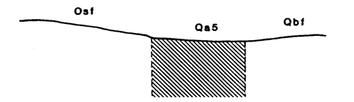
General Description:
A small area of mixed alluvium originating from two sources, the basalt plain and the sedimentary hills, dominated by the former. The soils are dominantly uniform reddish brown clay loams but being alluvial in nature are highly variable. Detailed information was not collected because of the units small size.
Site characteristics:
| Parent material age: | Quaternary/Ordovician | Depth seasonal watertable: | > 2 m |
| Lithology: | Basalt/Sedimentary | Potential recharge to groundwater: | Low |
| Landform Pattern: | Plain | Flooding risk: | Nil |
| Element: | Flat | Drainage: | Moderately well |
| Slope common; | 1% | Depth to hardrock: | > 2 m |
| Slope range: | 0-2% | ||
| Rock outcrop: | 0% |
Major vegetation: Cleared
Present land use: Cropping, grazing
| Land degradation: | Water erosion | Wind erosion | Salting | Acidification | |
Sheet/rill | Gully | ||||
| Susceptibility | Moderate | Low | Moderate | Moderate | Moderate |
| Incidence | Moderate | Low | Low | Low | Low |
Soil profile characteristics:
| Permeability (measured - average, range): | |
| Permeability (estimated): | Moderate |
| Available water capacity: | 380 mm H2O |
| Linear shrinkage (B horizon): | N.A. |
Soil profile description:
| A | 0-5 cm | Dark reddish brown (5YR3/2) clay loam, moderate structure, subangular blocky peds 2-5 mm, firm consistence, rough fabric, pH 6.5. Clear transition to |
| B21 | 5-32 cm | Dark reddish brown (5YR3/3) light fine sandy clay loam, massive hardpan, very firm consistence, pH 6.0. Gradual transition to |
| B22 | 32-60 cm | Dark reddish brown (5YR3/2) clay loam, massive, very firm consistence, a few organic segregations, pH 6.0. Clear transition to |
| B23 | 60+ cm | Reddish brown (5YR4/3) fine sandy loam, bleached (5YR7/3) when dry, massive, firm consistence, many ironstone fragments, pH 6.0 |
Soil classification:
| Factual Key (Northcote): | Um 5.31 |
| Australian Soil Classification: | Haplic, Duric, Red Kandosol, deep, thin, clay loamy, non-gravelly |
| Unified Soil Group: | ML |
Interpretation of soil analyses*
Horizon | pH | Gravel % | E.C. (salts) | Nutrient Status | P | K | Al | Organic Matter | Dispersibility |
| A | N.A. | N.A. | N.A. | N.A. | N.A. | N.A. | N.A. | N.A. | N.A. |
| B21 | N.A. | N.A. | N.A. | N.A. | N.A. | N.A. | N.A. | N.A. | N.A. |
| B22 | N.A. | N.A. | N.A. | N.A. | N.A. | N.A. | N.A. | N.A. | N.A. |
| B23 | N.A. | N.A. | N.A. | N.A. | N.A. | N.A. | N.A. | N.A. | N.A. |
Land capability assessment
Land Use | Class | Major limiting feature(s)/ landuse |
| Agriculture (CTS values) | C3T2S4 | Shallow top soil |
| Effluent disposal (septic tanks) | 3 | Moderate drainage, moderate permeability |
| Farm dams (earthen) | 4 | Low suitability of subsoil, highly dispersible subsoil |
| Building foundations - slab | 3 | Moderate drainage |
| Building foundations - stumps/footings | 3 | Moderate drainage |
| Secondary roads | 4 | Universal Soil Group |
| Urban residential | 4 | Secondary roads |
| Rural residential | 4 | Farm dams, secondary roads |
The high resolution PDF file provided on this page can be viewed using the free Adobe PDF reader, this software can be installed for free from the Adobe website (external link).
A Land Capability Study of the Rural City of Marong - map unit Qa5 - (PDF - 39.5 KB)