Victorian Resources Online (archived)
Marong map unit Qag
Back to: A Land Capability Study of the Rural City of Marong
| Map Unit: | Quaternary alluvium, drainage depression | Map Unit Symbol: | Qag |
| % of Study Area: | 1.6 |
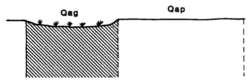
General Description:
The drainage depressions within the main alluvial plain are usually in the form of swamps or creeks such as Myers Creek. The soils associated with the creeks have not been described due to their highly variable nature and narrow coverage. The soils associated with the swamps are duplex with grey clay loam top soils and yellowish brown heavy clay subsoils. Minor variations include redder subsoils in less frequently wet areas, gradational soils and profiles with more uniform textures throughout. The creeks are often saline due to run off from the lower catchments, while the swamps are not.
Site characteristics:
| Parent material age: | Quaternary | Depth seasonal watertable: | 0 m |
| Lithology: | Alluvium | Potential recharge to groundwater: | Low |
| Landform Pattern: | Alluvial plain | Flooding risk: | High |
| Element: | Swamp | Drainage: | Poorly drained |
| Slope common: | 0.5% | Depth to hardrock: | > 2 m |
| Slope range: | 0-1% | ||
| Rock outcrop: | 0% |
Major vegetation: Red Gum, Grey Box, Yellow Box, Peppercorn, Round-leaf Wattle, Tussock grass, Rye Grass, Wallaby Grass.
Present land use: Partially forested, grazing sheep & cattle (major) cropping (minor)
| Land degradation: | Water erosion | Wind erosion | Salting | Acidification | |
Sheet/rill | Gully | ||||
| Susceptibility | Low | Moderate | High | Low | Moderate |
| Incidence | Low | Low | Moderate | Low | Low |
Soil profile characteristics:
| Permeability (measured - average, range): | - |
| Permeability (estimated): | Very slow |
| Available water capacity: | 279 mm H2O |
| Linear shrinkage (B horizon): | 15.0 % |
| A1 | 0-10 cm | Greyish yellow brown (10YR4/2) fine sandy clay loam, weak structure, subangular blocky peds less than 2 mm, smooth fabric, very weak consistence, high organic matter, pH 6.6, Clear transition to |
| A2 | 10-26 cm | Greyish yellow brown (10YR5/2) fine sandy loam, a few faint fine red mottles, moderate structure, subangular blocky peds 10-20 mm, smooth fabric, moderately firm consistence, a few iron segregations, pH 6.6. Clear transition to |
| B21 | 26-115 cm | Dull yellowish brown (10YR5/3) heavy clay, moderate structure, angular blocky peds 10-20 mm, smooth fabric, pH 6.9. Gradual transition to |
| B22 | 115-156+ cm | Dull yellowish brown (10YR5/3) light clay, strong structure, angular blocky peds 10-20 mm, smooth fabric, pH 7.1. |
Soil classification:
| Factual Key (Northcote): | Dy2.22 (major) Gn3.92/3, Gn3.52, Uf2 (minor) |
| Australian Soil Classification: | Chromosolic, Oxyaquic, Hydrosol; very deep, medium, clay loamy, non-gravelly |
| Unified Soil Group: | CL |
Interpretation of soil analyses*
Horizon | pH | Gravel % | E.C. (salts) | Nutrient Status | P | K | Al | Organic Matter | Dispersibility |
| A1 | 6.6 | 6.7 | VL | VH | D | S | S | H | L |
| A2 | 6.6 | 1.3 | VL | M | S | S | S | L | H |
| B21 | 6.9 | < 1 | VL | H | D | S | S | VL | M |
| B22 | 7.1 | < 1 | VL | M | D | S | S | VL | M |
Land capability assessment
Land Use | Class | Major limiting feature(s)/ landuse |
| Agriculture (CTS values) | C3T1S5 | High seasonal watertable |
| Effluent disposal (septic tanks) | 5 | Poor drainage, very slow permeability, high risk of flooding |
| Farm dams (earthen) | 5 | High seasonal watertable |
| Building foundations - slab | 5 | Poor drainage, high seasonal watertable, high risk of flooding |
| Building foundations - stumps/footings | 5 | Poor drainage, high seasonal watertable, high risk of flooding |
| Secondary roads | 5 | High risk of flooding, high seasonal watertable, very poor drainage |
| Urban residential | 5 | Secondary roads, building foundations |
| Rural residential | 5 | Farm dams effluent disposal, secondary roads, building foundations |
The high resolution PDF file provided on this page can be viewed using the free Adobe PDF reader, this software can be installed for free from the Adobe website (external link).
A Land Capability Study of the Rural City of Marong - map unit Qag - (PDF - 42 KB)