Victorian Resources Online (archived)
Site 31 Cullens Lake
Description
Located north of Kerang, this highly saline ephemeral wetland is surrounded by Open Herbland and is artificially fed through the Reedy Lake system, which is currently going through a wetting and drying cycle. When wet it provides a habitat for thousands of birds. Adjacent land uses include cropping and grazing.
| Vegetation Description and Composition Near the high water edge dominated by members of the Chenopodiaccae and Poaceae Families. There are small remnants of Woodland dominated by Eucalyptus largiflorens (Black Box). Spiny Lignum (a ‘Victorian rare or threatened species’) is still present. In 2002 almost half of the species present were introduced, including; Cristesion marinum (Sea Barley Grass), Lolium spp. (Rye Grass) and Lycium ferocissimum (African Boxthorn). In 2003, only 15% of plants present were introduced species and most of the introduced annuals were absent, due to the continued dry seasonal conditions. The abundance of all plants had been reduced. There had also been a decrease from seven salt species to five. Tree health continued to decline, with the general appearance of the trees indicating that they were under continued stress. There has been considerable change in the vegetation survey results due to dry seasonal conditions, compared with previous vegetation data. At the time of the survey the wetland was dry. | 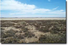 Cullens Lake |
Water Quality
Cullens Lake dried up in late April 2002 after a wetting cycle. It followed a typical saline wetland drying phase of getting more saline as the water level dropped – with the salinity rising to around 100 000 EC.
Groundwater and Salinity
The water table around the lake is fairly shallow coming within two metres of the surface around the high water mark and salinity is above 50 000 EC.
Threats to the site continue to be:
- extensive grazing by rabbits and continued insect attack to trees.
- inappropriate water regime and rising salinity levels.
Monitoring Survey Dates
December 1997, December 1998, December 1999, December 2000, November 2001, December 2002