Victorian Resources Online (archived)
Torrumbarry
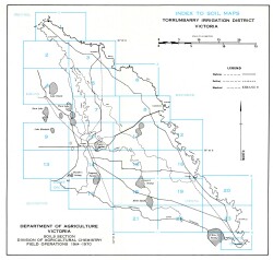
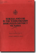
The report: 'Soils and Land Use in the Torrumbarry Irrigation District Victoria' was published by the Department of Agriculture in 1979 by Ian Sargeant, Jim Newell and Irwin Walbran. It is a detailed survey of approximately 127 000 hectares of farm land in parts of the counties of Gunbower and Tatchera near Kerang and was carried out by a team of Department of Agriculture soil surveyors. A downloadable version of the report is available below.
To view the information PDF requires the use of a PDF reader. This can be installed for free from the Adobe website (external link).
 | (PDF 1,126KB) | |
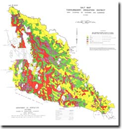
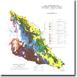 Soil Association Map - Torrumbarry Irrigation District (PDF 1.56MB) | ||
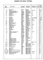
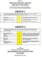
Key to Crop-Suitability Groups and Soil type Maps | ||