Victorian Resources Online (archived)
Wedderburn Mapsheet
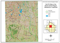 Wedderburn soil pit sites | A number of soil pit sites have been characterised on the Wedderburn mapsheet. Most of these have been selected as example profiles for major soil types in the area. It is not possible to give an estimate as to how representative these sites are of major soil types in the area. Care has been exercised in site selection to take into account local variations in geology and landform. Detailed soil mapping relating to this area - by Skene (1971) and Skene and Harford (1964) can be found elsewhere on this website. |