Victorian Resources Online (archived)
Archived content — This page contains material from the Victorian Resources Online (VRO) website. It is no longer maintained and is provided for reference only. This content is hosted by CeRDI and is not endorsed by Agriculture Victoria.
Sitemap
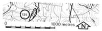
125. Poowong East - Basalt Boulders
|
This information has been developed from one or more of these publications:
- Sites of Geological and Geomorphological Significance in the Westernport Bay Catchment (1984) by Neville Rosengren.
- Sites of Geological and Geomorphological Significance in the Western Region of Melbourne (1986) by Neville Rosengren
- Sites of Geological and Geomorphological Significance on the Coast of Port Phillip Bay (1988) by Neville Rosengren.
- Sites of Environmental Significance in the Flood Plain of the Upper Yarra Valley Region (1983) by Neville Rosengren, Douglas Frood and Kim Lowe (as part of a study of Sites of Environmental Significance by the University of Melbourne for the then Upper Yarra Valley and Dandenong Ranges Authority).
Geological heritage sites, including sites of geomorphological interest and volcanic heritage sites, are under regular revision by the Geological Society of Australia, especially in the assessment of significance and values. Reference should be made to the most recent reports. See the Earth Science Heritage section of the Geological Society of Australia website (external link) for details of geological heritage reports, and a bibliography. |
Location: |
Poowong - 969580. Five kilometres north-east of Poowong. | |
Access: |
Olsens Road. |
Ownership: |
Private land. |
Geology: |
Boulders of hard fine-grained basalt outcropping in the creek bed indicate that a small dyke or pipe underlies the area. |
Significance: |
Local. The site is typical of the way that many small basaltic intrusions appear on the slopes and in valley bottoms in the Strzelecki Ranges. |
Management: |
Class 3. Water storage construction should not be permitted in the creek valley at this locality. |