Victorian Resources Online (archived)
Let4 - Lethbrige - Tertiary Section
|
This information has been developed from this publication:
|
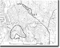
| Location: | Lethbridge - 490975. Shire of Bannockburn. Southern valley slope of Moorabool River, 3.5 km north of Lethbridge. | |
Access: | Acklands Road. | |
Ownership: | Private land. | |
Site Description: | On the undercut valley slope are outcrops of the gravels and sands that separate the calcareous Lower Maude Limestone Member from the Ordovician bedrock. The non-marine sediments are 20 m thick, with a basal conglomerate 3 to 4 m thick passing up into coarse sands and gravels, and grading higher up into Lower Maude Limestone Member overlain by Maude Basalt Member. | |
Significance: | Regional. The site is a clear display of the thickness of non-marine gravels at the base of the Maude Formation. | |
Management: | Class 2. Maintaining the site in rural land use will protect the significant sections. | |
References: | Bowler JM (1963) | |