Victorian Resources Online (archived)
Archived content — This page contains material from the Victorian Resources Online (VRO) website. It is no longer maintained and is provided for reference only. This content is hosted by CeRDI and is not endorsed by Agriculture Victoria.
Sitemap
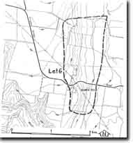
Let6 - Sutherlands Creek - Rowsley Fault
|
This information has been developed from this publication:
- Sites of Geological and Geomorphological Significance in the Western Region of Melbourne (1986) by Neville Rosengren
Geological heritage sites, including sites of geomorphological interest and volcanic heritage sites, are under regular revision by the Geological Society of Australia, especially in the assessment of significance and values. Reference should be made to the most recent reports. See the Earth Science Heritage section of the Geological Society of Australia website for details of geological heritage reports, and a bibliography. |
| Location: | Lethbridge - 152925. Shire of Bannockburn. Eastern side of Moorabool River, 3 km southeast of Lethbridge. | |
Access: |
Donaldsons Road, Bannockburn-Maude Road. |
Ownership: |
Private land. |
Site Description: |
Outcropping low on the valley slope is cross bedded Lower Maude Limestone Member resting with marked angular unconformity on steeply dipping Ordovician slate. |
Significance: |
Regional. The site is an illustration of the basal beds of the marine transgression. |
Management: |
Class 3. The site should be retained under rural land use. Buildings, excavation, or other forms of land use that would obscure the site should not be permitted. |