Victorian Resources Online (archived)
SV2 - Anakie Gorge - Structures
|
This information has been developed from this publication:
|
| Location: | Staughton Vale - 610060. Shire of Corio. Valley of Stony Creek, 2km south-west of Staughton Vale. | 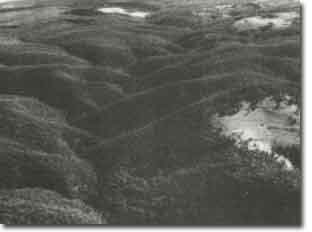 Anakie Gorge - Structures |
Access: | Anakie Gorge Road. | |
Ownership: | Crown land. | |
Site Description: | Stony Creek is deeply incised into the scarp of the Rowsley Fault. Numerous sedimentary structures including complex folding and fracture systems in the Ordovician sedimentary rocks are displayed in the walls of the gorge and in outcrops on the valley floor. | |
Significance: | Regional. The outcrops are an excellent display of the structures in the basement rocks of the Brisbane Ranges. The gorge is a major physiographic feature of the ranges. | |
Management: | Class 2. Maintenance of National Parks Service management principles is sufficient to protect the features of the site. | |
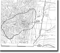 Site - SV2 |