Victorian Resources Online (archived)
Red Rock (Gisborne)
|
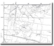
373100S 1443900E; 7822-4-1 (Sunbury) 918453. 6 km SE of Gisborne. Dalrymple Road. | 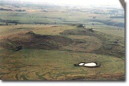 Red Rock (Gisborne) | |
Bulla. | ||
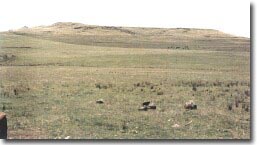
Private land. | Grazing, outcrop. | |
Type 9: | Composite lava and scoria volcano. | |
Red Rock is a flat-topped volcano surrounded by rocky escarpments apart from the eastern slope which descends gently to the surrounding lava plain. The flat capping resembles a lava disc overlying a scoria mound. Red scoria is exposed in small quarry cuts beneath the west-facing escarpment. | ||
490+ m; 45 m. | ||
Regional: | This volcano has an unusual flattened summit and may contain a higher percentage of scoria than is typical of the composite volcanoes in the Gisborne area. | |
Class 2: | Although a large feature, its proximity to Melbourne renders it liable to small farm or residential subdivision that would cover and disguise significant volcanic features. | |
References: | Edwards, A.B. & Crawford, W. (1940). The Cainzoic volcanic rocks of the Gisborne district, Victoria. Proceedings of the Royal Society of Victoria 52, pp. 281-311. | |
 Red Rock (Gisborne) | ||