Victorian Resources Online (archived)
Archived content — This page contains material from the Victorian Resources Online (VRO) website. It is no longer maintained and is provided for reference only. This content is hosted by CeRDI and is not endorsed by Agriculture Victoria.

Sitemap

Upper Yarra Valley - Healesville

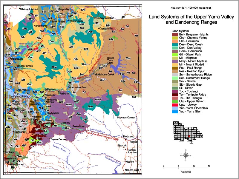
Back to: Land Systems - Upper Yarra Valley and Dandenong Ranges

This is a clickable map. Click on Land Unit in Legend for detailed information.

Upper Yarra Valley Land Systems Map - Healesville

Upper Yarra Valley - Land Systems Map - Healesville
Bel - Belgrave HeightsMil - MilgroveSev - SevilleUpw - Upwey
Chy - Chateau YeringMmy - Mount MyrtaliaSib - Siberia GapYaf - Yarra Floodplain
Ckt - CockatooMrl - Mount RiddellSil - SilvanYag - Yarra Glen
Dee - Deep CreekPau - Paul RangeToo - Toolangi
Don - Don ValleyRes - Reefton SpurTpr - Tentpole Ridge
Gem - GembrookScr - Schoolhouse RidgeTri - The Triangle
Gil - Gilwell ParkSet - Settlement RangeUbc - Upper Baker