Victorian Resources Online (archived)
MOP4
| Location: Red Hill | Australian Soil Classification: Red FERROSOL |
| Land Use: Orchard |
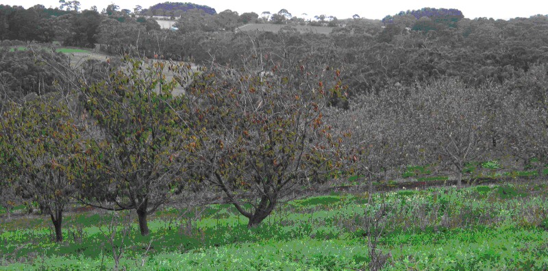
MOP4 Landscape
Soil Profile Morphology:
Surface Soil
| A1 | 0-12 cm | Dark reddish brown (5YR 3/2); clay loam; strong medium to very fine sub-angular blocky structure; very weak (moist) consistence; pH 6.0; clear change to: | 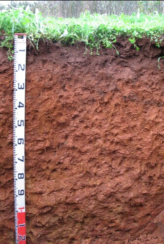 MOP4 Profile |
| Subsoil | |||
| B1 | 12-20 cm | Reddish brown (5YR 4/4); light clay; strong medium polyhedral; weak (moist) consistence; pH 5.7; gradual change to: | |
| B22 | 20-60 cm | Red (2.5YR 4/6); medium clay; strong medium to very fine polyhedral structure; weak (moist) consistence; pH 5.4; gradual change to: | |
| B23 | 60-110 cm | Reddish brown (2.5YR 4/4) with dark yellowish brown (10YR 5/6) mottles; light clay; pH 5.9: | |
| B24 | 110+ cm | Yellowish red (5YR 4/6) with brownish yellow (10YR 6/6) mottles; light clay; pH 5.6. | |
Key Profile Features:
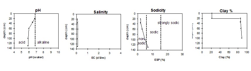
Soil Profile Characteristics:
pH | Salinity Rating | |||
Surface (A1 horizon) | Moderately Acid | |||
Subsoil (B21 horizon) | Moderately Acid | |||
Deeper subsoil (at 110+ cm) | Moderately Acid |
Horizon | Horizon Depth | pH (water) | pH CaCl2 | EC 1:5 | NaCl | Exchangeable Cations | |||
Ca | Mg | K | Na | ||||||
Meq/100g | |||||||||
A1 | 0-12 | 6 | 5.3 | 5.7 | 0.19 | 8.8 | 2.4 | 3 | 0.27 |
B1 | 12-20 | 5.7 | 5.2 | 1.9 | 0.17 | 4.8 | 1.8 | 1.2 | 0.18 |
B22 | 20-60 | 5.7 | 5.4 | 0.09 | 3.2 | 7 | 0.38 | 0.48 | |
B23 | 60-110 | 5.9 | 5.6 | 0.1 | 2.5 | 9.5 | 0.2 | 0.68 | |
B24 | 110+ | 6 | 5.1 | 0.11 | 2.2 | 11 | 0.1 | 1.1 | |
Horizon | Horizon Depth | Ex Al mg/kg | Iron g/100g | Ex Ac meq/100g | Field pF 2.5 | Wilting Point pF4.2 g/100g | Coarse Sand (0.2-2.0mm) % | Fine Sand (0.02-0.2mm) % | Silt (0.002-0.02mm) % | Clay (<0.002mm) % |
A1 | 0-12 | 0.74 | 7.8 | 17 | 40 | 17.1 | 7 | 28 | 31 | 22 |
B1 | 12-20 | 0.74 | 9.8 | 9.4 | 31.3 | 15.9 | 4 | 30 | 27 | 34 |
B22 | 20-60 | 0.23 | 2.7 | 12 | 52.4 | 33 | 0 | 8 | 12 | 76 |
B23 | 60-110 | 0.29 | 3.2 | 11 | 55.8 | 34.3 | 7 | 7 | 12 | 77 |
B24 | 110+ | 0.34 | 3.5 | 12 | 57 | 33.8 |