Victorian Resources Online (archived)
Archived content — This page contains material from the Victorian Resources Online (VRO) website. It is no longer maintained and is provided for reference only. This content is hosted by CeRDI and is not endorsed by Agriculture Victoria.
Sitemap
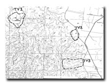
TV3 Murray Spur - Lava Ridge
|
This information has been developed from the publications:
- Sites of Geological and Geomorphological Significance in the Western Region of Melbourne (1986) by Neville Rosengren
- Sites of Geological and Geomorphological Significance on the Coast of Port Phillip Bay (1988) by Neville Rosengren.
- Sites of Geological and Geomorphological Significance in the Shire of Otway (1984) by Neville Rosengren.
Geological heritage sites, including sites of geomorphological interest and volcanic heritage sites, are under regular revision by the Geological Society of Australia, especially in the assessment of significance and values. Reference should be made to the most recent reports. See the Earth Science Heritage section of the Geological Society of Australia website (external link) for details of geological heritage reports, and a bibliography. |
| Location | Toolern Vale - 837434. Former Shire of Gisborne. Ridge extending west from Gisborne - Melton Road, 6 km southwest from Gisborne. | |
Ownership |
Gisborne - Melton Road. |
Access |
Mainly private land, some Crown land. |
Site Description |
Murray Spur is a convex ridge capped by one of the early flows from Mount Gisborne that filled a small valley cut into Ordovician sediments. The flow now forms a distinctive rounded ridge on the margins of the Gisborne Highlands. |
Significance |
Local. The site is an example of one of the earlier Mount Gisborne flows and a small scale example of topographic inversion. |
Management |
Class 3. Continuation as rural land or small farm subdivision would retain the significant form of the site. |
References |
Crawford, W. (1939). The Physiography of the Gisborne Highlands. Proc. R. Soc. Vict. 52:262-279. |