Victorian Resources Online (archived)
Archived content — This page contains material from the Victorian Resources Online (VRO) website. It is no longer maintained and is provided for reference only. This content is hosted by CeRDI and is not endorsed by Agriculture Victoria.

Sitemap

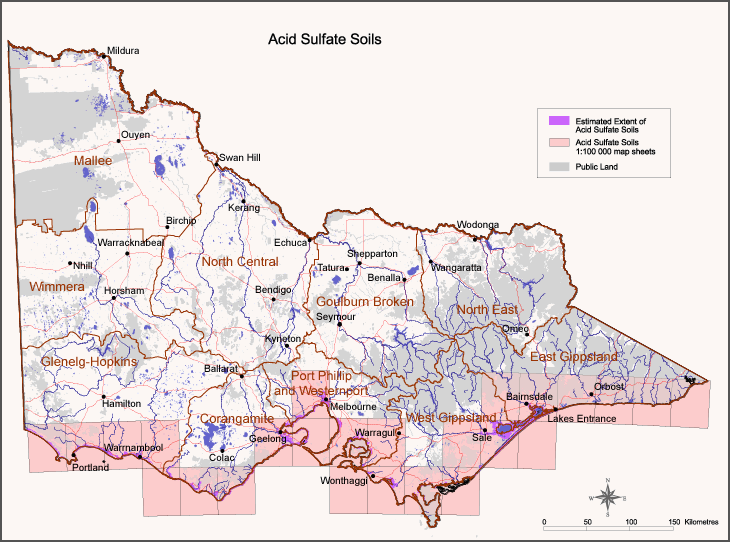
Map key to 1:100,000 mapsheets showing current mapping of potential Coastal Acid Sulfate Soils

Back to: Coastal Acid Sulfate Soils

Image:  Coastal Acid Sulphate Soils

To view the information PDF requires the use of a PDF reader. This can be installed for free from the Adobe website (external link).

Coastal Acid Sulfate Soil Hazard Maps
Bairnsdale - T8422 and Stockyard - T8421 (PDF - 995 Kb)Murrungowar - T8622 (PDF - 717 Kb)Sorrento - T7821 (PDF - 850 Kb)
Cann - T8722 (PDF - 650 Kb)Nelson - T7121 (PDF - 765 Kb)Traralgon - T8221 (PDF - 960 Kb)
Foster - T8120 (PDF - 911 Kb)Orbost - T8522(PDF - )Warragul - T8021 (PDF - 970 Kb)
Geelong - T7721 (PDF - 465 Kb)Otway - T7620 (PDF - 745 Kb)Warrnambool - T7321 (PDF - )
Mallacoota - T8822 (PDF - 850 Kb)Portland - T7221 (PDF - 775 Kb)Westernport - T7921and Woolami - T7920 (PDF - 475 Kb)
Melbourne - T7822 (PDF - 425 Kb)Princetown - T7520 (PDF - 670 Kb)Wonthaggi - T8020 (PDF - 500 Kb)
Mortlake - T7421and Port Campbell - T7420 (PDF - 535 Kb)Sale - T8321 (PDF - 975 Kb)Yarram - T8220 (PDF - 405 Kb)