Victorian Resources Online (archived)
Salinity Provinces in the East Gippsland Catchment Management Region
The East Gippsland Catchment Management Region (CMR) covers almost 10% of Victoria and is located in the far eastern part of the State. This CMA Region is dominated by the hills and mountains of the Great Dividing Range that grade down to the southern coast and coastal plains in the south-west.
The climate is temperate, with patterns of precipitation and temperature influenced by geography, topography, altitude and proximity to the coast. Rainfall ranges from over 1000 mm per year at the higher elevations, down to 715 mm/year at Bairnsdale. In the higher regions, maximum rainfall occurs in winter and spring, although high-intensity rains can occur at any time of the year. On the coastal plains, rainfall is more evenly distributed throughout the year.
Most of the catchment is public land (87%), with agricultural activity largely confined to the better quality lands along the river valleys, plateaus and coastal plains around Lakes Entrance to Bairnsdale. East Gippsland in general was never densely settled and the large areas in public ownership mainly support a timber industry, rather than agriculture.
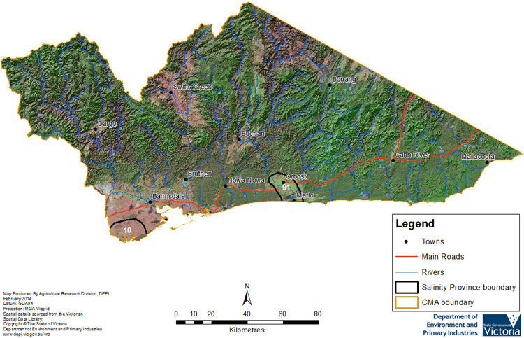
Dryland salinity is limited in East Gippsland with a recorded area of under 1000 hectares1 (0.04% of the CMA area) spread across 43 individual mapping units1, the smallest area and least number of units of any CMA in the State. These have been grouped into two Salinity Provinces, one of which is High priority. The Provinces are generally associated with coastal salinity processes, the more significant one being the Bengworden area adjoining the West Gippsland CMA on the Gippsland Lakes.
The East Gippsland CMA has an extensive range of online materials (maps and documents etc.) which outline the biophysical assets of the catchment, as well as their major risks (including soil and water salinity). This material also outlines the programs and projects currently being completed by the CMA to protect and enhance these assets. An example of this is the East Gippsland CMA ‘Regional Catchment Strategy’ (RCS), the link to which can be found at the base of this page.
Provinces displayed in this map are clickable or use the table of links provided
Links to further reading and material related to the East Gippsland CMR
East Gippsland Catchment Management Authority region on VRO
East Gippsland Corangamite Catchment Management Authority
East Gippsland CMA ‘Regional Catchment Strategy’ (RCS)
East Gippsland CMA ‘Waterway Strategy’
Information about bores and groundwater resources in the East Gippsland CMA can be found on the Visualising Victoria's Groundwater (VVG) website