Victorian Resources Online (archived)
7. Gelliondale Monocline
This information has been developed from the publication:
|
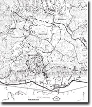
| Location: | 475206. North of the South Gippsland Highway between Agnes River and Lamont Creek. | 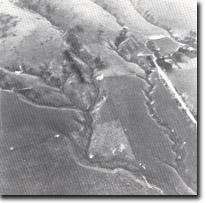 Eroded alluvial fans at base of Gelliondale Monocline escarpment. |
Access: | South Gippsland Highway. | |
Ownership: | Private Land. | |
Geology/Geomorphology: | The Gelliondale Monocline is a clearly defined structure that dilineates the southern margin of the South Gippsland Hills between Foster and Welshpool. The South Gippsland Highway traverses the base of the hills along the alignment of the monocline and crosses the broad alluvial fan deposits here. The fans slope steeply to the south and are incised by streams such as Lamont Creek. | |
Significance: | Regional. This is a clear sample of the control of structural factors on relief in South Gippsland. | |
Management: | Because of the area covered by the site, the value of the significant geological/geomorphological features is unlikely to be seriously reduced by localised land disturbance. | |