Victorian Resources Online (archived)
Archived content — This page contains material from the Victorian Resources Online (VRO) website. It is no longer maintained and is provided for reference only. This content is hosted by CeRDI and is not endorsed by Agriculture Victoria.
Sitemap
13. Toms Cap
|
This information has been developed from the publications:
- Sites of Geological and Geomorphological Significance in Central Gippsland (1981) by Neville Rosengren, M.S McRae-Williams and S.M Kraemers,
- Sites of Geological and Geomorphological Significance on the Coast of Port Phillip Bay and in the Catchment of Westernport Bay (1984, 88) by Neville Rosengren.
- Sites of Geological and Geomorphological Significance in the South Gippsland Marine and Coastal Parks (1989) by Neville Rosengren.
Geological heritage sites, including sites of geomorphological interest and volcanic heritage sites, are under regular revision by the Geological Society of Australia, especially in the assessment of significance and values. Reference should be made to the most recent reports. See the Earth Science Heritage (external link) section of the Geological Society of Australia website for details of geological heritage reports, and a bibliography. |
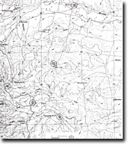
| Location: | 816583. Ten kilometres south of Willung. | |
Access: |
Toms Cap Road. |
Ownership: |
Crown Land. |
Geology/Geomorphology: |
This low hill top is formed in ferruginous beds of the Haunted Hill Gravels. |
Significance: |
Local. This is a clear example of ferruginous cementation in the Haunted Hill Gravels. |
Management: |
Limited quarrying would not seriously reduce the value of the site but representative sections should be retained in quarries. |