Victorian Resources Online (archived)
Archived content — This page contains material from the Victorian Resources Online (VRO) website. It is no longer maintained and is provided for reference only. This content is hosted by CeRDI and is not endorsed by Agriculture Victoria.
Sitemap
16. Carrajung South Road Cutting
|
This information has been developed from the publications:
- Sites of Geological and Geomorphological Significance in Central Gippsland (1981) by Neville Rosengren, M.S McRae-Williams and S.M Kraemers,
- Sites of Geological and Geomorphological Significance on the Coast of Port Phillip Bay and in the Catchment of Westernport Bay (1984, 88) by Neville Rosengren.
- Sites of Geological and Geomorphological Significance in the South Gippsland Marine and Coastal Parks (1989) by Neville Rosengren.
Geological heritage sites, including sites of geomorphological interest and volcanic heritage sites, are under regular revision by the Geological Society of Australia, especially in the assessment of significance and values. Reference should be made to the most recent reports. See the Earth Science Heritage (external link) section of the Geological Society of Australia website for details of geological heritage reports, and a bibliography. |
| Location: | 825510. | 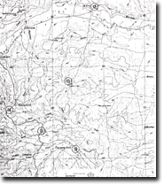
Sites 8221 - 12 to 16 |
Access: |
Yarram-Traralgon Road near Carrajung South. |
Ownership: |
Crown Land |
Geology/Geomorphology: |
A large, steep, road-side batter exposes an irregular, unconformable contact between the Haunted Hill Gravels and the upper section of the La Trobe Valley Group. |
Significance: |
Local. The site provides an easily accessible area in which to observe lithological variation within the upper La Trobe Valley Group which consists of white micaceous, often hard clay, silt and silty sand with minor clayey, feldspathic coarse sand, igneous clay and brown coal. |
Management: |
Maintenance of clear exposures in the Yarram-Traralgon Road cutting at this site would enhance the significance of the site. |