Victorian Resources Online (archived)
Devon (Dv)
|
| Geology Mid-Pleistocene terrace deposits (former early Quaternary terraces of the Tarra, Jack and Albert Rivers). Landform Undulating plain. |

| Land Use All of this map unit is cleared and is used for grazing. | 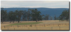 View from near Yarram towards terrace of the Devon landscape unit (in middleground). |
Soils
The surface soils are dark grey to dark brown clay loams to fine sandy clay loams about 20 to 40 cm deep overlying a greyish brown to light brownish grey similarly textured subsurface. At about 40 to 60 cm a yellowish brown or brownish yellow medium clay with increasing grey mottles abruptly appears which continues to at least 120 cm. Soil Site GP43 is located on this map unit and is a brown Sodosol.