Victorian Resources Online (archived)
Foster (Fo)
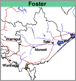 | Geology Tertiary sediments, probably derived from the Mount Hoddle Range. Landform Undulating rises. |
Land Use
Most of the area is cleared and used for grazing.
Soils
The soils of this map unit are characterised by surface soils that are dark grey to very dark grey gravelly loams to gravelly sandy loams. At about 10 to 25 cm there is a bleached subsurface soil, typically a grey to light grey gravelly loam to gravelly sandy loam. Mottled light grey and brownish yellow medium clays, occasionally sandy clays or gravelly clays, occur from about 40 to 60 cm. Often there is a cemented or strongly compacted zone above the clay subsoil.