Victorian Resources Online (archived)
Gurdies (Gd)
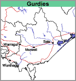 | This small unit occurs on the Western edge of the Warragul mapsheet. It is close to the coastline on the eastern side of Port Phillip Bay and lies within the Port Phillip and Westernport region. Soil Site GP56 is an example of a Brown Kurosol that occurs in the Gurdies mapping unit. |