Victorian Resources Online (archived)
Maryvale (Ma)
| Geology Late Tertiary sediments (Pliocene). Landform Rolling Low Hills to Undulating Rises. | 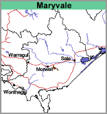 |
Most of the soils of the Maryvale map unit are texture contrast soils meaning that a light textured surface soil, generally a fine sandy loam rests abruptly on mottled grey and yellowish brown clay. The subsoil clay generally has a pH less than 5.5 and it is generally both sodic and magnesic. Sites CFTT9 and CFTT10 are examples of soils of the Maryvale map unit.
Other map units on the Late Tertiary sediments in this area are Morwell, Boolarra, Stockdale and Loy Yang. Morwell has a deep gritty soil which becomes more clayey with depth. Boolarra has a deeper and more “loamy” topsoil and generally lacks a sharp texture contrast. Both Stockdale and Loy Yang have similar soils i.e. texture contrast soils with a strongly bleached subsurface soil. Loy Yang occurs on weakly dissected red gum plains.
Land Use
Plantation forestry, some grazing.