Victorian Resources Online (archived)
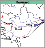
Reynard (Rd)
 |
Geology
The rocks within this map unit are comprised of Devonian intrusives (Mt Taylor porphyry) and Carboniferous sediments.
Landform
Rolling to steep hills.
Soils
Most of this complex has shallow soils with large areas of rock outcrop. Two profiles examined on the lower slopes (less than 20%) had the following characteristics:
Surface Soil
One dark grey (10YR4/1), the other brown (10YR5/3) clay loam.
Subsoil
Abrupt boundaries at 25 and 30 cm, both subsoils yellowish brown (10YR5/6) medium clay.
Chemical and Physical Analyses
No chemical and physical analyses were carried out on these soils.
Land Use
Mostly under forest, some grazing. It may be convenient to separate two components within this unit mapping out the areas with slopes generally less than (say) 20%, as the more gentle slopes are less likely to be prone to erosion.