Victorian Resources Online (archived)
Archived content — This page contains material from the Victorian Resources Online (VRO) website. It is no longer maintained and is provided for reference only. This content is hosted by CeRDI and is not endorsed by Agriculture Victoria.
Sitemap
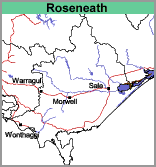
Roseneath (Rn)
- Roseneath, clay surface (Rn,c)
- Roseneath, sandy loam surface (Rn,sl)
- Roseneath, clay surface and Roseneath, sandy loam (Rn,c:Rn,sl)
This unit is restricted to heavy textured surface soils with some areas being covered by a veneer of sandy loam surface, particularly around Strathfieldsaye.
Aldrick et al (1992) included this unit within their
Clydebank map unit (Component 3) and
Ward (1977) included it within his
Reeve map unit.
Geology
Holocene sediments (Mostly Qrm with some Qrd – see
Geology and Geomorphology) which were most likely deposited under
paludal or
lacustrine conditions (lake or marshy conditions).
Landform
Marine plain.
Soils
Two main soil types have been identified on the map,
Roseneath clay surface (Rn,c) and
Roseneath sandy loam surface (Rn,sl).